Approximate Location Map
Large Map »
Latitude: 51.0614 / 51°3'41"N
Longitude: -1.808 / 1°48'28"W
OS Eastings: 413551
OS Northings: 129138
OS Grid: SU135291
Mapcode National: GBR 51D.CPX
Mapcode Global: FRA 7639.TQK
Plus Code: 9C3W356R+HR
Entry Name: Outbuilding to West of Old Parsonage
Listing Date: 12 October 1972
Grade: II
Source: Historic England
Source ID: 1023679
English Heritage Legacy ID: 319169
ID on this website: 101023679
Location: Harnham, Wiltshire, SP2
County: Wiltshire
Civil Parish: Salisbury
Built-Up Area: Salisbury
Traditional County: Wiltshire
Lieutenancy Area (Ceremonial County): Wiltshire
Church of England Parish: Harnham St George and All Saints
Church of England Diocese: Salisbury
Tagged with: Appendage
HARNHAM ROAD
1.
1594 WEST HARNHAM
Outbuilding to west of
Old Parsonage
SU 1329 10/346B
II GV
2.
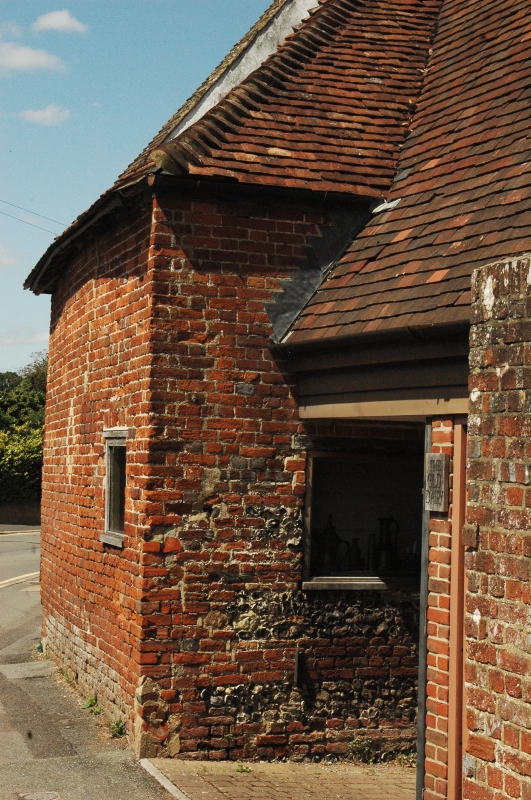
1 storey and loft red brick Cl8/Cl9, Hipped old tile roof. The upper part
of wall at north end is weatherboarded. Stable door and double doors.
Old Parsonage and outbuildings form a group.
Listing NGR: SU1355129138
External links are from the relevant listing authority and, where applicable, Wikidata. Wikidata IDs may be related buildings as well as this specific building. If you want to add or update a link, you will need to do so by editing the Wikidata entry.


Other nearby listed buildings
