Approximate Location Map
Large Map »
Latitude: 50.8829 / 50°52'58"N
Longitude: -0.3112 / 0°18'40"W
OS Eastings: 518893
OS Northings: 110631
OS Grid: TQ188106
Mapcode National: GBR HLT.D5D
Mapcode Global: FRA B67R.W0N
Plus Code: 9C2XVMMQ+5G
Entry Name: The Old Priory
Listing Date: 9 May 1980
Grade: II
Source: Historic England
Source ID: 1027462
English Heritage Legacy ID: 298339
ID on this website: 101027462
Location: Upper Beeding, Horsham, West Sussex, BN44
County: West Sussex
District: Horsham
Civil Parish: Bramber
Built-Up Area: Upper Beeding
Traditional County: Sussex
Lieutenancy Area (Ceremonial County): West Sussex
Church of England Parish: Beeding St Peter and Bramber St Nicholas
Church of England Diocese: Chichester
Tagged with: Building
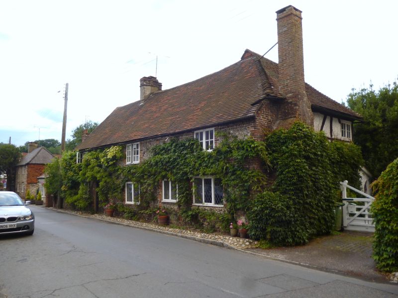
BRAMBER THE STREET
1. (north side)
5404
The Old Priory
TQ 1810 25/47
II
2.
C17 or earlier timber-framed building now faced with flints with red brick
dressings and quoins, but some timbering with plaster infilling visible in
east wall. Tiled roof. Brick chimney breast at west end. Casement windows.
Two storeys. Four windows.
Listing NGR: TQ1889310631
External links are from the relevant listing authority and, where applicable, Wikidata. Wikidata IDs may be related buildings as well as this specific building. If you want to add or update a link, you will need to do so by editing the Wikidata entry.


Other nearby listed buildings
