Approximate Location Map
Large Map »
Latitude: 51.3177 / 51°19'3"N
Longitude: 0.8923 / 0°53'32"E
OS Eastings: 601648
OS Northings: 161592
OS Grid: TR016615
Mapcode National: GBR SW3.BDT
Mapcode Global: VHKJW.F43P
Plus Code: 9F328V9R+3W
Entry Name: Wall Enclosing Garden Behind No 25 on North Side
Listing Date: 3 August 1972
Grade: II
Source: Historic England
Source ID: 1069488
English Heritage Legacy ID: 175898
ID on this website: 101069488
Location: Faversham, Swale, Kent, ME13
County: Kent
District: Swale
Civil Parish: Faversham
Built-Up Area: Faversham
Traditional County: Kent
Lieutenancy Area (Ceremonial County): Kent
Tagged with: Wall
C0URT STREET
1.
1103 (West Side)
-----------
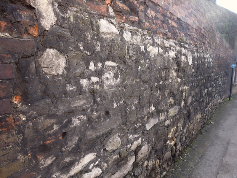
Wall enclosing garden
behind No 25 on North side
TR 0161 NE 1/29A
II
2i
Wall mostly of stone rubble off medieval origin; some brick. Incorporates
a gateway and extends as far West as The Two Brewers Public House.
Listing NGR: TR0165061592
External links are from the relevant listing authority and, where applicable, Wikidata. Wikidata IDs may be related buildings as well as this specific building. If you want to add or update a link, you will need to do so by editing the Wikidata entry.


Other nearby listed buildings
