Approximate Location Map
Large Map »
Latitude: 51.1264 / 51°7'35"N
Longitude: 1.3179 / 1°19'4"E
OS Eastings: 632259
OS Northings: 141586
OS Grid: TR322415
Mapcode National: GBR X2Z.B0N
Mapcode Global: VHLHB.SYLC
Plus Code: 9F3348G9+H5
Entry Name: 11, Castle Hill Road
Listing Date: 17 December 1973
Grade: II
Source: Historic England
Source ID: 1069525
English Heritage Legacy ID: 177730
ID on this website: 101069525
Location: Victoria Park Mews, Dover, Kent, CT16
County: Kent
District: Dover
Civil Parish: Dover
Built-Up Area: Dover
Traditional County: Kent
Lieutenancy Area (Ceremonial County): Kent
Tagged with: Building
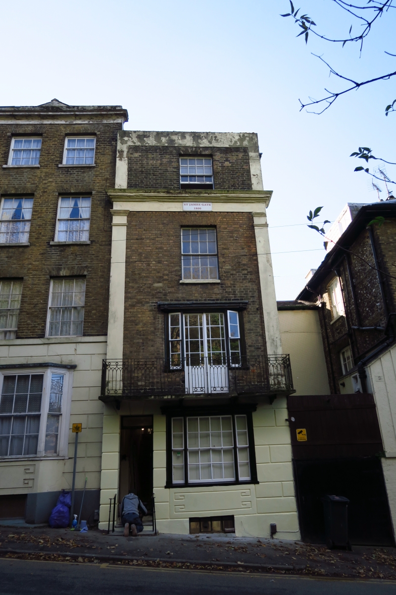
CASTLE HILL ROAD
l. (South East Side)
1050
No 11
TR 3241 1/84
II GV
2.
Early C19. 4 storeys stock brick. Parapet. Dropped moulded eaves cornice
with pilasters at each end. 1 sash with glazing bars intact. French window
on lst floor opening on to a decorated cast iron balcony. Very narrow 3-light
canted bay on ground floor. 6-panelled door. Simple cast iron hand rails.
Nos 9 to 13 (consec) form a group.
Listing NGR: TR3225941586
External links are from the relevant listing authority and, where applicable, Wikidata. Wikidata IDs may be related buildings as well as this specific building. If you want to add or update a link, you will need to do so by editing the Wikidata entry.


Other nearby listed buildings
