Approximate Location Map
Large Map »
Latitude: 51.1259 / 51°7'33"N
Longitude: 1.3153 / 1°18'55"E
OS Eastings: 632080
OS Northings: 141520
OS Grid: TR320415
Mapcode National: GBR X2Z.9CT
Mapcode Global: VHLHB.RY7R
Plus Code: 9F3348G8+94
Entry Name: 40, Castle Street
Listing Date: 17 December 1973
Grade: II
Source: Historic England
Source ID: 1069528
English Heritage Legacy ID: 177738
ID on this website: 101069528
Location: Victoria Park Mews, Dover, Kent, CT16
County: Kent
District: Dover
Civil Parish: Dover
Built-Up Area: Dover
Traditional County: Kent
Lieutenancy Area (Ceremonial County): Kent
Tagged with: Building
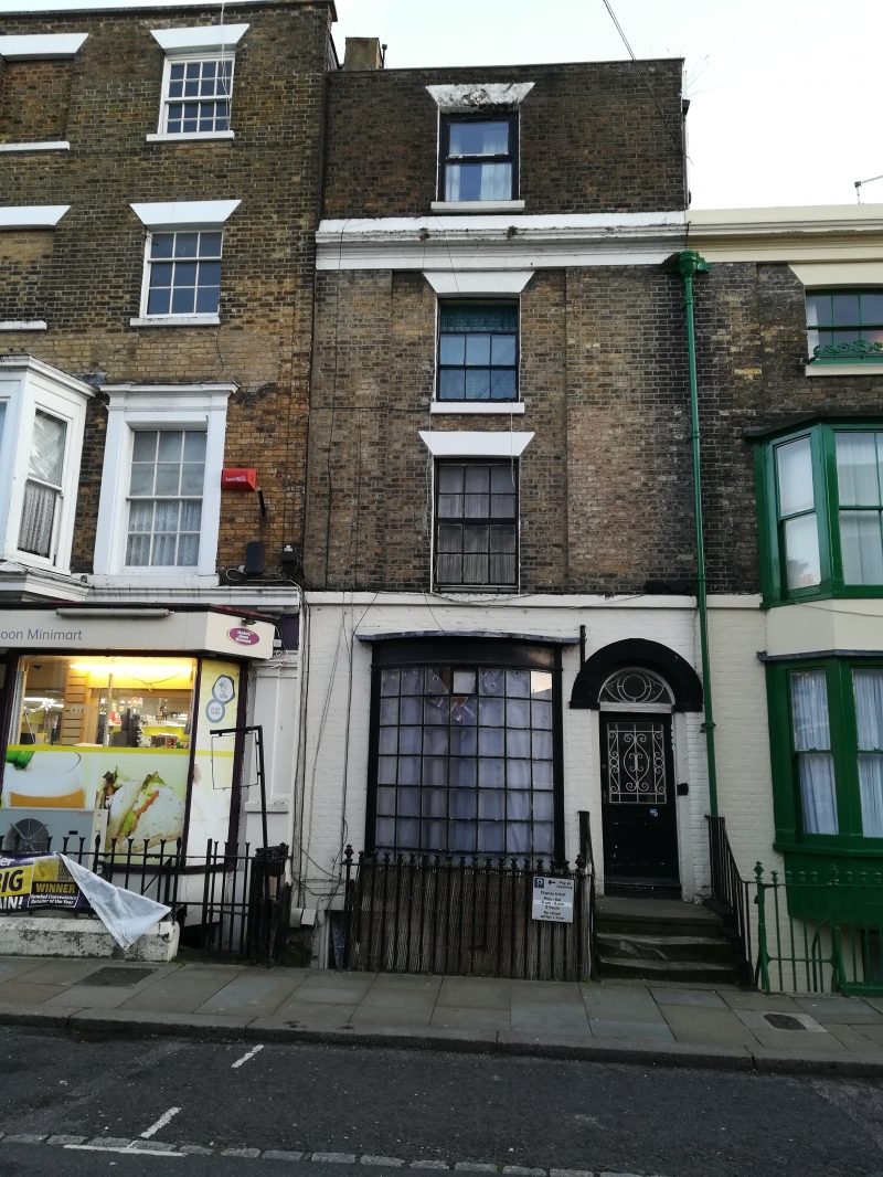
CASTLE STREET
l. (South East Side)
1050
No 40
TR 3241 1/21
II GV
2.
Mid C19. 4 storey and basement (the top storey added later). Parapet and
cornice above 2nd floor. Stringcourse above ground floor. 1 sash. Contemporary
curved shop window with its glazing bars intact. Round-headed doorcase.
Nos 16 to 68 (even) form a group.
Listing NGR: TR3208041520
External links are from the relevant listing authority and, where applicable, Wikidata. Wikidata IDs may be related buildings as well as this specific building. If you want to add or update a link, you will need to do so by editing the Wikidata entry.


Other nearby listed buildings
