Approximate Location Map
Large Map »
Latitude: 51.355 / 51°21'17"N
Longitude: 1.0255 / 1°1'31"E
OS Eastings: 610754
OS Northings: 166113
OS Grid: TR107661
Mapcode National: GBR TX1.VG3
Mapcode Global: VHKJR.Q6HL
Plus Code: 9F33923G+X5
Entry Name: 61, Oxford Street
Listing Date: 20 May 1977
Grade: II
Source: Historic England
Source ID: 1084906
English Heritage Legacy ID: 170855
ID on this website: 101084906
Location: Whitstable, Canterbury, Kent, CT5
County: Kent
District: Canterbury
Electoral Ward/Division: Gorrell
Parish: Non Civil Parish
Built-Up Area: Whitstable
Traditional County: Kent
Lieutenancy Area (Ceremonial County): Kent
Tagged with: Building
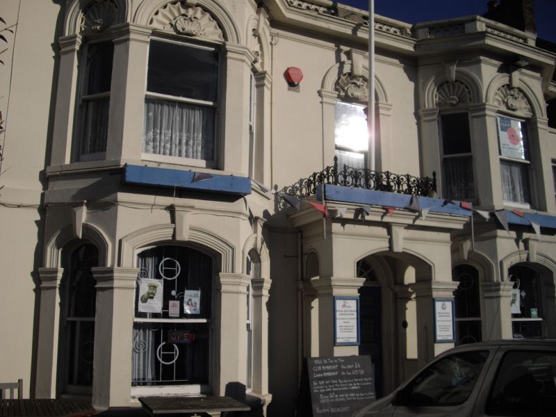
OXFORD STREET
1.
5273
(East Side)
No 61
TR 1066 SE 2/171
II GV
2.
Mid C19 double fronted house with bays, rendered with shell-like motifs over 1st
floor windows. Porch. Large squares to windows. Slate roof.
Listing NGR: TR1075466113
External links are from the relevant listing authority and, where applicable, Wikidata. Wikidata IDs may be related buildings as well as this specific building. If you want to add or update a link, you will need to do so by editing the Wikidata entry.


Other nearby listed buildings
