Approximate Location Map
Large Map »
Latitude: 50.8979 / 50°53'52"N
Longitude: -1.3979 / 1°23'52"W
OS Eastings: 442436
OS Northings: 111113
OS Grid: SU424111
Mapcode National: GBR RRL.02
Mapcode Global: FRA 76YQ.R67
Plus Code: 9C2WVJX2+5R
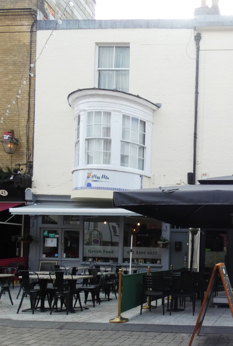
Entry Name: 44, Oxford Street
Listing Date: 8 October 1981
Grade: II
Source: Historic England
Source ID: 1092030
English Heritage Legacy ID: 135872
ID on this website: 101092030
Location: Ocean Village, Southampton, Hampshire, SO14
County: City of Southampton
Electoral Ward/Division: Bargate
Parish: Non Civil Parish
Built-Up Area: Southampton
Traditional County: Hampshire
Lieutenancy Area (Ceremonial County): Hampshire
Church of England Parish: Southampton City Centre St Mary
Church of England Diocese: Winchester
Tagged with: Building
1. OXFORD STREET
5239 (south side)
No 44
SU 4211 4/180
II GV
2.
Early C19. Three storeys painted brick. One sash window to second floor,
cantilevered bow to first floor. Later C19 shopfront to ground floor.
Listing NGR: SU4243511107
External links are from the relevant listing authority and, where applicable, Wikidata. Wikidata IDs may be related buildings as well as this specific building. If you want to add or update a link, you will need to do so by editing the Wikidata entry.


Other nearby listed buildings
