Approximate Location Map
Large Map »
Latitude: 51.3914 / 51°23'29"N
Longitude: 0.3953 / 0°23'42"E
OS Eastings: 566747
OS Northings: 168539
OS Grid: TQ667685
Mapcode National: GBR NN5.QRR
Mapcode Global: VHJLR.S9T6
Plus Code: 9F3299RW+H4
Entry Name: The Terrace
Listing Date: 21 November 1966
Grade: II
Source: Historic England
Source ID: 1096318
English Heritage Legacy ID: 356745
ID on this website: 101096318
Location: Cobham, Gravesham, Kent, DA12
County: Kent
District: Gravesham
Civil Parish: Cobham
Built-Up Area: Cobham
Traditional County: Kent
Lieutenancy Area (Ceremonial County): Kent
Church of England Parish: Cobham St Mary Magdalene
Church of England Diocese: Rochester
Tagged with: Building
TQ 66 NE COBHAM THE STREET
5/19 (south side)
21.11.66 Nos 1 to 4 (inclusive)
(The Terrace)
II
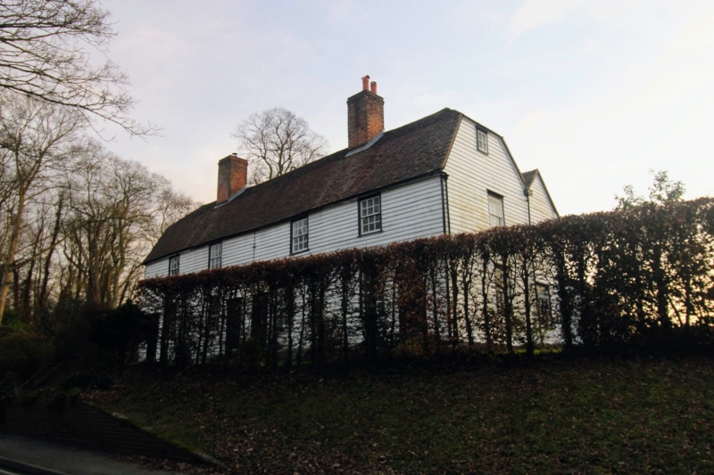
Row of 4 C18 timber weatherboarded cottages. Two storeys with attic. Tiled
half-hipped roof. Doorways and windows have small wooden hoods on brackets. Casement
windows with glazing bars.
Listing NGR: TQ6675368538
External links are from the relevant listing authority and, where applicable, Wikidata. Wikidata IDs may be related buildings as well as this specific building. If you want to add or update a link, you will need to do so by editing the Wikidata entry.


Other nearby listed buildings
