Approximate Location Map
Large Map »
Latitude: 51.0063 / 51°0'22"N
Longitude: -2.195 / 2°11'41"W
OS Eastings: 386415
OS Northings: 123005
OS Grid: ST864230
Mapcode National: GBR 1XH.XHV
Mapcode Global: FRA 669G.6NZ
Plus Code: 9C3V2R44+G2
Entry Name: 51, High Street
Listing Date: 15 October 1973
Grade: II
Source: Historic England
Source ID: 1108747
English Heritage Legacy ID: 102053
ID on this website: 101108747
Location: Shaftesbury, Dorset, SP7
County: Dorset
Civil Parish: Shaftesbury
Built-Up Area: Shaftesbury
Traditional County: Dorset
Lieutenancy Area (Ceremonial County): Dorset
Church of England Parish: Shaftesbury St Peter
Church of England Diocese: Salisbury
Tagged with: Building
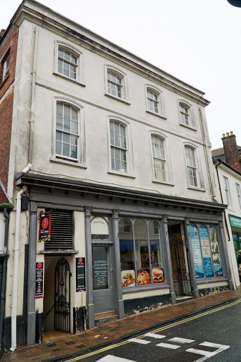
1.
1615 HIGH STREET
(South Side)
No 51
ST 8623 1/63
II GV
2.
Probably an early C18 house with later cement-rendering. 3-storey, 4-window
front. Windows have segmental heads. Shop front. Some C18 internal features
[see RCHM] Glazing bars intact.
Nos 43 to 53 (odd) form a group.
Listing NGR: ST8641523005
External links are from the relevant listing authority and, where applicable, Wikidata. Wikidata IDs may be related buildings as well as this specific building. If you want to add or update a link, you will need to do so by editing the Wikidata entry.


Other nearby listed buildings
