Approximate Location Map
Large Map »
Latitude: 53.2565 / 53°15'23"N
Longitude: -1.7315 / 1°43'53"W
OS Eastings: 418009
OS Northings: 373310
OS Grid: SK180733
Mapcode National: GBR JZBS.XB
Mapcode Global: WHCD0.CDQV
Plus Code: 9C5W7749+H9
Entry Name: Gate Post at Os 180 733
Listing Date: 22 March 1985
Grade: II
Source: Historic England
Source ID: 1109900
English Heritage Legacy ID: 80915
ID on this website: 101109900
Location: Cressbrook, Derbyshire Dales, Derbyshire, DE45
County: Derbyshire
District: Derbyshire Dales
Civil Parish: Great Longstone
Traditional County: Derbyshire
Lieutenancy Area (Ceremonial County): Derbyshire
Church of England Parish: Longstone St Giles
Church of England Diocese: Derby
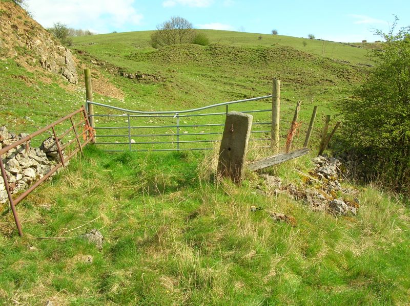
SK 17 SE PARISH OF GREAT LONGSTONE HAY DALE
3/4 (West Side)
Gatepost at OS 180 733
II
Guidestone now used as a gatepost. Dated 1737, Square gritstone block about three feet tall with flat top, Inscribed 1737 and BAKEWELL/ROAD. Further inscription hidden from view,
Listing NGR: SK1800973310
External links are from the relevant listing authority and, where applicable, Wikidata. Wikidata IDs may be related buildings as well as this specific building. If you want to add or update a link, you will need to do so by editing the Wikidata entry.


Other nearby listed buildings
