Approximate Location Map
Large Map »
Latitude: 51.8799 / 51°52'47"N
Longitude: -0.5631 / 0°33'47"W
OS Eastings: 499002
OS Northings: 221119
OS Grid: SP990211
Mapcode National: GBR F3T.2FR
Mapcode Global: VHFRK.604Q
Plus Code: 9C3XVCHP+WP
Entry Name: Old Farm Public House
Listing Date: 26 September 1980
Grade: II
Source: Historic England
Source ID: 1114769
English Heritage Legacy ID: 36169
ID on this website: 101114769
Location: Totternhoe, Central Bedfordshire, LU6
County: Central Bedfordshire
Civil Parish: Totternhoe
Built-Up Area: Totternhoe
Traditional County: Bedfordshire
Lieutenancy Area (Ceremonial County): Bedfordshire
Church of England Parish: Totternhoe
Church of England Diocese: St.Albans
Tagged with: Pub
1.
5125 TOTTERNHOE CHURCH ROAD
(north-west side)
Church End
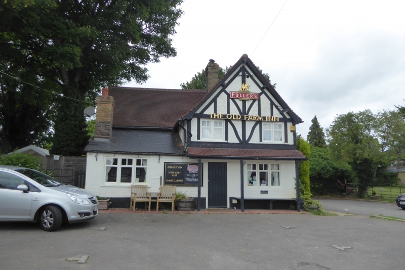
Old Farm Public House
SP 9821 32/387
SP 9921 33/387
II
2.
C17 with later additions and alterations. Timber-framed with colourwashed
brick nogging. Two storeys. Clay tile roof. Modern casements. Mock timber-framing
to front elevation.
Listing NGR: SP9900221119
External links are from the relevant listing authority and, where applicable, Wikidata. Wikidata IDs may be related buildings as well as this specific building. If you want to add or update a link, you will need to do so by editing the Wikidata entry.


Other nearby listed buildings
