Approximate Location Map
Large Map »
Latitude: 51.7716 / 51°46'17"N
Longitude: -0.9292 / 0°55'45"W
OS Eastings: 473983
OS Northings: 208646
OS Grid: SP739086
Mapcode National: GBR C1T.ZWQ
Mapcode Global: VHDV8.VQ4R
Plus Code: 9C3XQ3CC+J8
Entry Name: 12, High Street
Listing Date: 11 October 1985
Grade: II
Source: Historic England
Source ID: 1118272
English Heritage Legacy ID: 43193
ID on this website: 101118272
Location: Haddenham, Buckinghamshire, HP17
County: Buckinghamshire
Civil Parish: Haddenham
Built-Up Area: Haddenham
Traditional County: Buckinghamshire
Lieutenancy Area (Ceremonial County): Buckinghamshire
Church of England Parish: Haddenham
Church of England Diocese: Oxford
Tagged with: Building
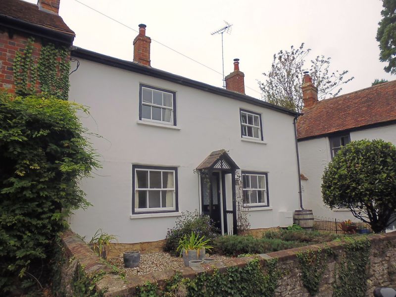
SP 7308 HADDENHAM HIGH STREET
(west side)
10/252 No.12
-
GV II
House. Early C19. Witchert on a rubble plinth, colourwashed and
rendered. Slate roof. 2 bays and 2 storeys. 4 panel centre door
with trellised slate roofed open porch. 3 pane box sashes. Stacks
off centre and to right gable.
Listing NGR: SP7398208648
External links are from the relevant listing authority and, where applicable, Wikidata. Wikidata IDs may be related buildings as well as this specific building. If you want to add or update a link, you will need to do so by editing the Wikidata entry.


Other nearby listed buildings
