Approximate Location Map
Large Map »
Latitude: 50.7333 / 50°43'59"N
Longitude: -2.7543 / 2°45'15"W
OS Eastings: 346859
OS Northings: 92904
OS Grid: SY468929
Mapcode National: GBR PP.L62Q
Mapcode Global: FRA 5734.QR9
Plus Code: 9C2VP6MW+87
Entry Name: 65, East Street
Listing Date: 19 September 1975
Grade: II
Source: Historic England
Source ID: 1119001
English Heritage Legacy ID: 104520
ID on this website: 101119001
Location: New Zealand, Dorset, DT6
County: Dorset
Civil Parish: Bridport
Built-Up Area: Bridport
Traditional County: Dorset
Lieutenancy Area (Ceremonial County): Dorset
Church of England Parish: Bridport St Mary
Church of England Diocese: Salisbury
Tagged with: Building
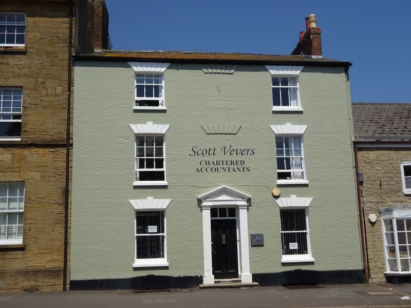
1.
1591 EAST STREET
(North Side)
No 65
SY 4692 1/70
II GV
2.
C18/early C19. Colourwashed brick. 3 storeys. 3 ranges of windows with
stone or stucco rusticated voussoirs, central range blind. Door with moulded
panelling and fanlight in doorway with Tuscan pilasters taking pediment.
Nos 61 to 115 (odd) and wall from east end of No 115 form a group.
Listing NGR: SY4685692904
External links are from the relevant listing authority and, where applicable, Wikidata. Wikidata IDs may be related buildings as well as this specific building. If you want to add or update a link, you will need to do so by editing the Wikidata entry.


Other nearby listed buildings
