Approximate Location Map
Large Map »
Latitude: 54.3855 / 54°23'7"N
Longitude: -2.9139 / 2°54'49"W
OS Eastings: 340746
OS Northings: 499278
OS Grid: SD407992
Mapcode National: GBR 8K2Q.YP
Mapcode Global: WH82M.61P9
Plus Code: 9C6V93PP+6C
Entry Name: Drinking Fountain
Listing Date: 7 February 1973
Grade: II
Source: Historic England
Source ID: 1124678
English Heritage Legacy ID: 351654
ID on this website: 101124678
Location: Windermere, Westmorland and Furness, Cumbria, LA23
County: Cumbria
District: South Lakeland
Civil Parish: Windermere
Built-Up Area: Windermere
Traditional County: Westmorland
Lieutenancy Area (Ceremonial County): Cumbria
Church of England Parish: Windermere (Applethwaite) St Mary
Church of England Diocese: Carlisle
Tagged with: Drinking fountain
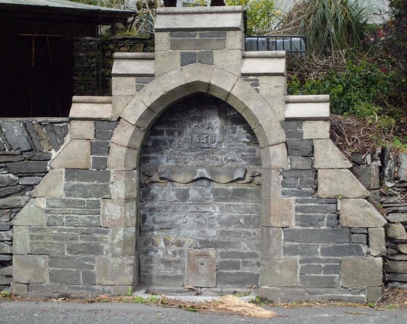
AMBLESIDE ROAD
1.
1834
Drinking Fountain
SD 49 NW 4/40
II
2.
Beside the Wynlass Beck, on east side of road. 1858, Gothic styled, with
pointed arch in castellated walling.
Listing NGR: SD4074699278
External links are from the relevant listing authority and, where applicable, Wikidata. Wikidata IDs may be related buildings as well as this specific building. If you want to add or update a link, you will need to do so by editing the Wikidata entry.


Other nearby listed buildings
