Approximate Location Map
Large Map »
Latitude: 51.5835 / 51°35'0"N
Longitude: -0.7411 / 0°44'28"W
OS Eastings: 487318
OS Northings: 187932
OS Grid: SU873879
Mapcode National: GBR D5Q.RFN
Mapcode Global: VHDWC.3GKF
Plus Code: 9C3XH7M5+9G
Entry Name: Pound
Listing Date: 8 January 1987
Grade: II
Source: Historic England
Source ID: 1125609
English Heritage Legacy ID: 46951
ID on this website: 101125609
Location: Little Marlow, Buckinghamshire, SL7
County: Buckinghamshire
Civil Parish: Little Marlow
Traditional County: Buckinghamshire
Lieutenancy Area (Ceremonial County): Buckinghamshire
Church of England Parish: Great Marlow with Marlow Bottom, Little Marlow and Bisham
Church of England Diocese: Oxford
Tagged with: Building
LITTLE MARLOW CHURCH ROAD (off)
SU 88 NE
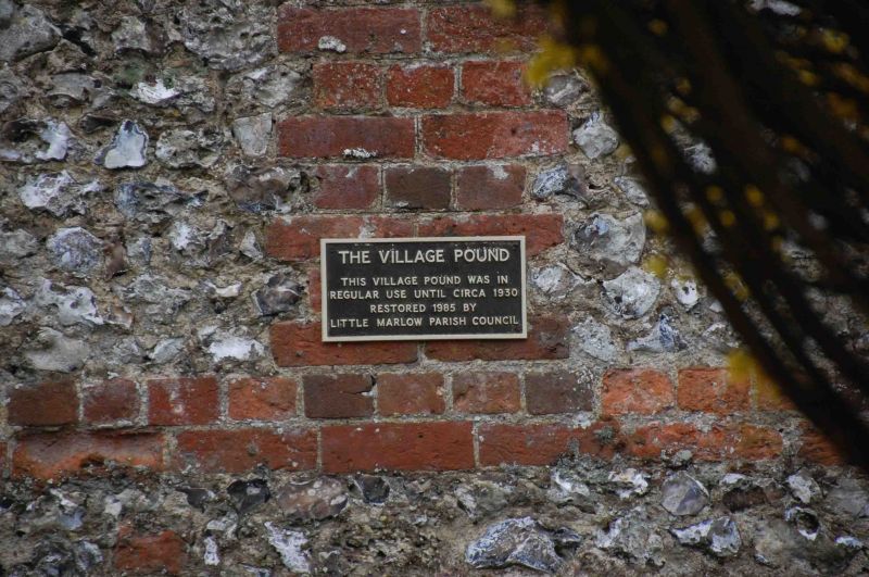
5/67 Pound
-
GV II
Pound. Early-mid C19. Flint walls with brick dressings. N.E. and S.E.
sides incorporate part of garden wall of Manor House. Entrance in N.W.
side.
Listing NGR: SU8731887932
External links are from the relevant listing authority and, where applicable, Wikidata. Wikidata IDs may be related buildings as well as this specific building. If you want to add or update a link, you will need to do so by editing the Wikidata entry.


Other nearby listed buildings
