Approximate Location Map
Large Map »
Latitude: 52.1817 / 52°10'54"N
Longitude: 0.0891 / 0°5'20"E
OS Eastings: 542932
OS Northings: 255770
OS Grid: TL429557
Mapcode National: GBR L7M.5BY
Mapcode Global: VHHK8.HFHD
Plus Code: 9F4253JQ+MM
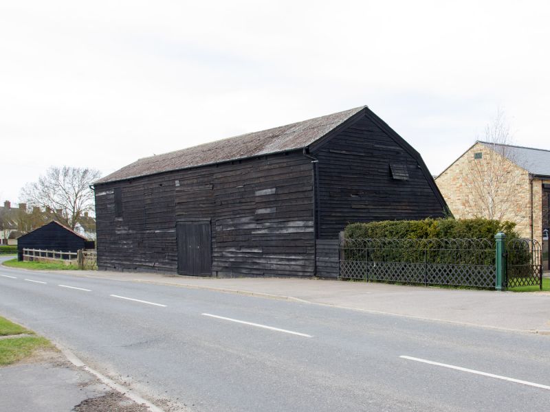
Entry Name: Barn at Lacies Farm
Listing Date: 31 May 1985
Grade: II
Source: Historic England
Source ID: 1127786
English Heritage Legacy ID: 51720
ID on this website: 101127786
Location: Grantchester, South Cambridgeshire, CB3
County: Cambridgeshire
District: South Cambridgeshire
Civil Parish: Grantchester
Built-Up Area: Grantchester
Traditional County: Cambridgeshire
Lieutenancy Area (Ceremonial County): Cambridgeshire
Church of England Parish: Grantchester St Andrew and St Mary
Church of England Diocese: Ely
Tagged with: Barn
TL 45 NW GRANTCHESTER COTON ROAD
(North Side)
4/103 Barn at Lacies
Farm
GV II
Barn. C18. Timber-framed, weatherboarded. Single aisled and of four bays.
Braced tie beams and Queen strut roof trusses.
Listing NGR: TL4293255770
External links are from the relevant listing authority and, where applicable, Wikidata. Wikidata IDs may be related buildings as well as this specific building. If you want to add or update a link, you will need to do so by editing the Wikidata entry.


Other nearby listed buildings
