Approximate Location Map
Large Map »
Latitude: 52.4031 / 52°24'10"N
Longitude: -0.0832 / 0°4'59"W
OS Eastings: 530500
OS Northings: 280066
OS Grid: TL305800
Mapcode National: GBR K3C.9SV
Mapcode Global: VHGLK.HVWP
Plus Code: 9C4XCW38+6P
Entry Name: The Chestnuts
Listing Date: 4 November 1982
Grade: II
Source: Historic England
Source ID: 1128360
English Heritage Legacy ID: 54199
ID on this website: 101128360
Location: Ramsey End, Huntingdonshire, Cambridgeshire, PE28
County: Cambridgeshire
District: Huntingdonshire
Civil Parish: Warboys
Built-Up Area: Warboys
Traditional County: Huntingdonshire
Lieutenancy Area (Ceremonial County): Cambridgeshire
Church of England Parish: Warboys St Mary Magdalene
Church of England Diocese: Ely
Tagged with: Architectural structure
WARBOYS HIGH STREET
1.
5140
(south side)
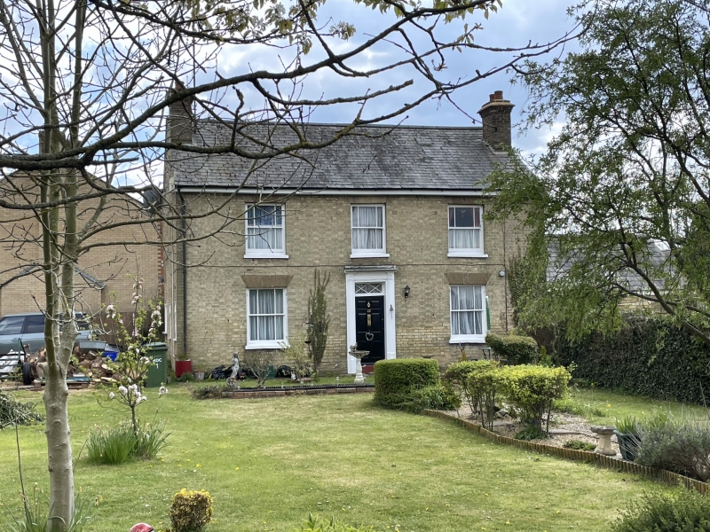
No 22 (The Chestnuts)
TL 38 SW 2/3
II GV
2.
Early C19 house. Gault brick. Slate roof. End stacks. Two-storeys. Range of three
hung sashes with margin lights. Two similar windows flank central doorway. Reeded
doorcase with boss enrichments at corners.
Listing NGR: TL3050080066
External links are from the relevant listing authority and, where applicable, Wikidata. Wikidata IDs may be related buildings as well as this specific building. If you want to add or update a link, you will need to do so by editing the Wikidata entry.


Other nearby listed buildings
