Approximate Location Map
Large Map »
Latitude: 50.2151 / 50°12'54"N
Longitude: -5.4791 / 5°28'44"W
OS Eastings: 151892
OS Northings: 40805
OS Grid: SW518408
Mapcode National: GBR DXV3.P1J
Mapcode Global: VH12D.ZV8G
Plus Code: 9C2P6G8C+29
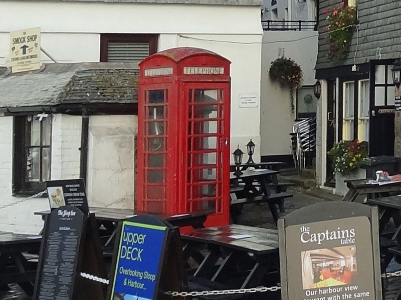
Entry Name: K6 Telephone Kiosk, Wharf Road, Weighbridge
Listing Date: 8 November 1989
Grade: II
Source: Historic England
Source ID: 1137088
English Heritage Legacy ID: 69160
ID on this website: 101137088
Location: St Ives, Cornwall, TR26
County: Cornwall
Civil Parish: St. Ives
Built-Up Area: St Ives
Traditional County: Cornwall
Lieutenancy Area (Ceremonial County): Cornwall
Church of England Parish: St Ives
Church of England Diocese: Truro
Tagged with: K6 telephone box
Tis list entry was subject to a Minor Amendment on 04/04/2014
SW 54 SW
1/301
ST. IVES
WHARF RD, WEIGHBRIDGE
K6 Telephone Kiosk
GV
II
Telephone kiosk. Type K6. Designed 1935 by Sir Giles Gilbert Scott.
Made by various contractors. Cast iron. Square kiosk with domed
roof. Unperforated crowns to top panels and margin glazing to windows
and door.
Listing NGR: SW5189240805
External links are from the relevant listing authority and, where applicable, Wikidata. Wikidata IDs may be related buildings as well as this specific building. If you want to add or update a link, you will need to do so by editing the Wikidata entry.


Other nearby listed buildings
