Approximate Location Map
Large Map »
Latitude: 54.7156 / 54°42'55"N
Longitude: -3.4968 / 3°29'48"W
OS Eastings: 303671
OS Northings: 536644
OS Grid: NY036366
Mapcode National: GBR 4F0X.RD
Mapcode Global: WH5YB.8Q2V
Plus Code: 9C6RPG83+67
Entry Name: 57, Kirkby Street
Listing Date: 27 May 1977
Grade: II
Source: Historic England
Source ID: 1137597
English Heritage Legacy ID: 71840
ID on this website: 101137597
Location: Maryport, Cumberland, Cumbria, CA15
County: Cumbria
District: Allerdale
Civil Parish: Maryport
Built-Up Area: Maryport
Traditional County: Cumberland
Lieutenancy Area (Ceremonial County): Cumbria
Church of England Parish: Maryport St Mary with Christ Church
Church of England Diocese: Carlisle
Tagged with: Building
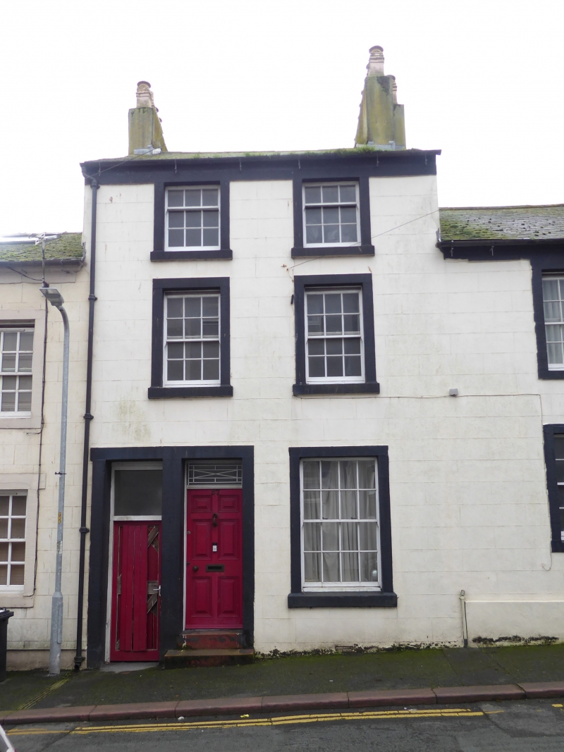
MARYPORT KIRKBY STREET
1.
5161 (South Side)
-------------
No 57
NY 0336 1/74
II GV
Early C19. 3 storeys, rendered, with stone slate roof and eaves cornice. 2
windows on 2 floors and 1 to ground, most hung sashes with glazing bars. Stone
surround to door of 6 fielded panels, joint with surround to passage entry.
2 steps up. Ornamented rectangular fanlight.
Listing NGR: NY0367136644
External links are from the relevant listing authority and, where applicable, Wikidata. Wikidata IDs may be related buildings as well as this specific building. If you want to add or update a link, you will need to do so by editing the Wikidata entry.


Other nearby listed buildings
