Approximate Location Map
Large Map »
Latitude: 54.7057 / 54°42'20"N
Longitude: -3.3851 / 3°23'6"W
OS Eastings: 310847
OS Northings: 535398
OS Grid: NY108353
Mapcode National: GBR 4GS0.YX
Mapcode Global: WH6ZH.ZZ6F
Plus Code: 9C6RPJ47+7X
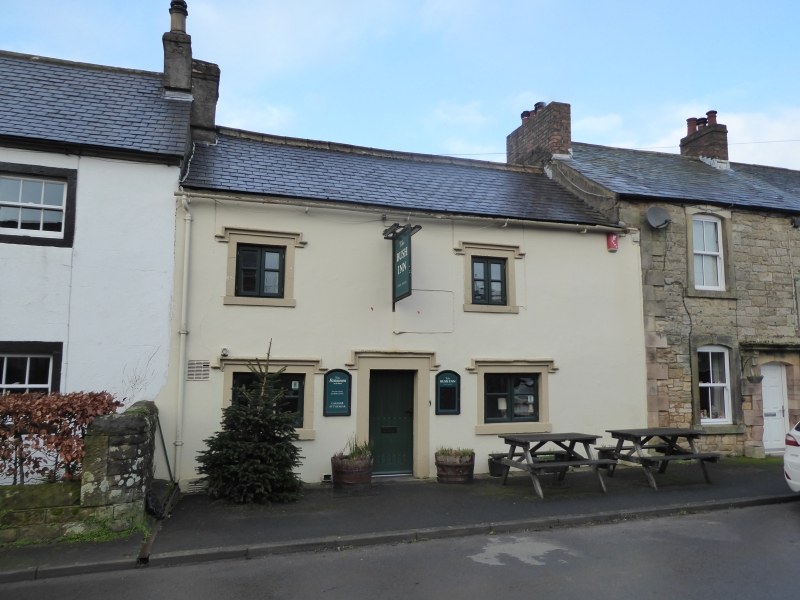
Entry Name: Bush Inn
Listing Date: 20 June 1973
Grade: II
Source: Historic England
Source ID: 1138147
English Heritage Legacy ID: 72593
ID on this website: 101138147
Location: Tallentire, Cumberland, Cumbria, CA13
County: Cumbria
District: Allerdale
Civil Parish: Bridekirk
Traditional County: Cumberland
Lieutenancy Area (Ceremonial County): Cumbria
Church of England Parish: Cockermouth Area Team
Church of England Diocese: Carlisle
Tagged with: Inn
BRIDEKIRK TALLENTIRE
NY 13 NW
2/70 Bush Inn
G.V. II
20-6-73
House, now Public House. Probably late C17 with C19 alterations. Painted
rendered walls under Welsh slate roof with cement rendered chimney stack. 2
storeys, 2 bays. C20 studded plank door in painted stone surround and C20
casement windows, all under early C19 hoodmoulds.
Listing NGR: NY1084735398
External links are from the relevant listing authority and, where applicable, Wikidata. Wikidata IDs may be related buildings as well as this specific building. If you want to add or update a link, you will need to do so by editing the Wikidata entry.


Other nearby listed buildings
