Approximate Location Map
Large Map »
Latitude: 54.2032 / 54°12'11"N
Longitude: -2.5969 / 2°35'48"W
OS Eastings: 361161
OS Northings: 478769
OS Grid: SD611787
Mapcode National: GBR BM9V.L1
Mapcode Global: WH94P.2MN3
Plus Code: 9C6V6C33+76
Entry Name: 4, Mill Brow
Listing Date: 22 March 1983
Grade: II
Source: Historic England
Source ID: 1145763
English Heritage Legacy ID: 75222
Also known as: The Blue Pig
ID on this website: 101145763
Location: Kirkby Lonsdale, Westmorland and Furness, Cumbria, LA6
County: Cumbria
District: South Lakeland
Civil Parish: Kirkby Lonsdale
Built-Up Area: Kirkby Lonsdale
Traditional County: Westmorland
Lieutenancy Area (Ceremonial County): Cumbria
Church of England Parish: Kirkby Lonsdale Team Ministry
Church of England Diocese: Carlisle
Tagged with: Building
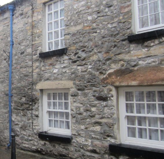
MILL BROW
1.
5166 (north side)
No 4
SD 6178 NW 5/108
II GV
2.
C19. Two storeys. Rubble. Slate roof. Windows with sills and plain reveals,
sashed with all glazing bars except shop window with fixed panes. Modern door.
Included for group value.
Listing NGR: SD6116178769
External links are from the relevant listing authority and, where applicable, Wikidata. Wikidata IDs may be related buildings as well as this specific building. If you want to add or update a link, you will need to do so by editing the Wikidata entry.


Other nearby listed buildings
