Approximate Location Map
Large Map »
Latitude: 51.6808 / 51°40'50"N
Longitude: -0.6615 / 0°39'41"W
OS Eastings: 492638
OS Northings: 198852
OS Grid: SU926988
Mapcode National: GBR F60.FLL
Mapcode Global: VHFSG.H04T
Plus Code: 9C3XM8JQ+8C
Entry Name: The Crown Public House
Listing Date: 17 March 1982
Grade: II
Source: Historic England
Source ID: 1161913
English Heritage Legacy ID: 44474
ID on this website: 101161913
Location: Little Missenden, Buckinghamshire, HP7
County: Buckinghamshire
Civil Parish: Little Missenden
Traditional County: Buckinghamshire
Lieutenancy Area (Ceremonial County): Buckinghamshire
Church of England Parish: Little Missenden
Church of England Diocese: Oxford
Tagged with: Pub
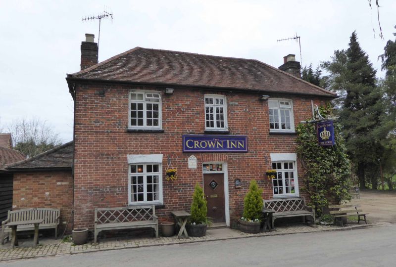
LITTLE MISSENDEN MILL END
1.
5134
(north side)
The Crown
SU 9298 4/30 Public House
2.
Early C19. Three bay, 2 storey house in red brick with some grey bricks. Hipped
tiled roof with end stacks. Gauged flat arches to ground floor, cambered under.
Recessed barred sashes. Central door. Two storey modern flat roof and parapeted
extension.
Listing NGR: SU9263898852
External links are from the relevant listing authority and, where applicable, Wikidata. Wikidata IDs may be related buildings as well as this specific building. If you want to add or update a link, you will need to do so by editing the Wikidata entry.


Other nearby listed buildings
