Approximate Location Map
Large Map »
Latitude: 53.4842 / 53°29'2"N
Longitude: -2.3348 / 2°20'5"W
OS Eastings: 377880
OS Northings: 398657
OS Grid: SJ778986
Mapcode National: GBR DX44.BR
Mapcode Global: WH989.3PGB
Plus Code: 9C5VFMM8+M3
Entry Name: Sundial South of Church of St Mary
Listing Date: 16 July 1987
Grade: II
Source: Historic England
Source ID: 1162811
English Heritage Legacy ID: 211936
ID on this website: 101162811
Location: Eccles, Salford, Greater Manchester, M30
County: Salford
Electoral Ward/Division: Eccles
Parish: Non Civil Parish
Built-Up Area: Eccles
Traditional County: Lancashire
Lieutenancy Area (Ceremonial County): Greater Manchester
Church of England Parish: Eccles St Mary the Virgin
Church of England Diocese: Manchester
Tagged with: Sundial
ECCLES CHURCH STREET
SJ 79 NE
(east side)
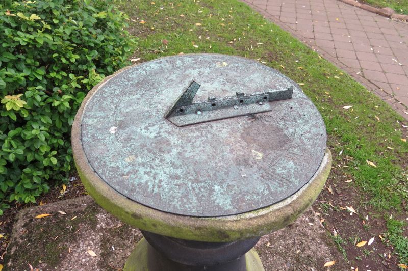
4/3 Sundial south
- of Church of
St. Mary
G.V. II
Sundial. Late C18. Ashlar. Bulbous baluster-type shaft with
bronze dial (gnomon broken). Concrete base.
Listing NGR: SJ7788098657
External links are from the relevant listing authority and, where applicable, Wikidata. Wikidata IDs may be related buildings as well as this specific building. If you want to add or update a link, you will need to do so by editing the Wikidata entry.


Other nearby listed buildings
