Approximate Location Map
Large Map »
Latitude: 54.2989 / 54°17'56"N
Longitude: -2.1994 / 2°11'57"W
OS Eastings: 387119
OS Northings: 489273
OS Grid: SD871892
Mapcode National: GBR FL2Q.MQ
Mapcode Global: WHB5M.56XQ
Plus Code: 9C6V7RX2+H6
Entry Name: Gayle Bridge
Listing Date: 25 March 1969
Grade: II
Source: Historic England
Source ID: 1166665
English Heritage Legacy ID: 323143
ID on this website: 101166665
Location: Gayle, North Yorkshire, DL8
County: North Yorkshire
District: Richmondshire
Civil Parish: Hawes
Built-Up Area: Hawes
Traditional County: Yorkshire
Lieutenancy Area (Ceremonial County): North Yorkshire
Tagged with: Bridge
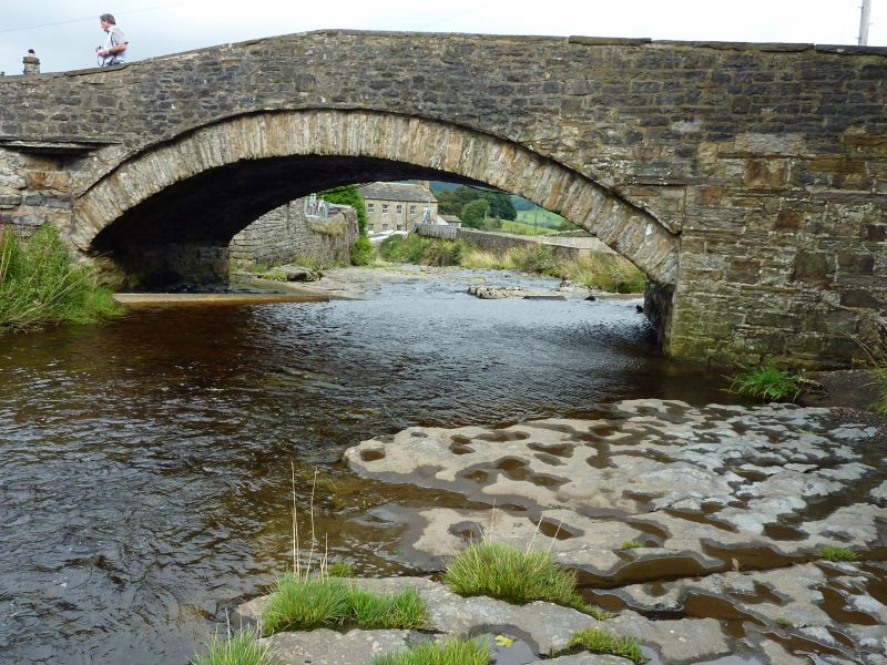
HAWES EAST END, Gayle
SD 88 NE
20/120 Gayle Bridge
25.3.69
GV II
Bridge. Late C18 - early C19. Single segmental arch of rubble voussoirs
with hood-mould. Slab coping to parapets.
Listing NGR: SD8711989273
External links are from the relevant listing authority and, where applicable, Wikidata. Wikidata IDs may be related buildings as well as this specific building. If you want to add or update a link, you will need to do so by editing the Wikidata entry.


Other nearby listed buildings
