Approximate Location Map
Large Map »
Latitude: 52.3992 / 52°23'56"N
Longitude: 0.2574 / 0°15'26"E
OS Eastings: 553682
OS Northings: 280301
OS Grid: TL536803
Mapcode National: GBR M6G.KXF
Mapcode Global: VHHJ6.DYYP
Plus Code: 9F4297X4+MX
Entry Name: The Barn
Listing Date: 19 June 1972
Grade: II
Source: Historic England
Source ID: 1167539
English Heritage Legacy ID: 48716
ID on this website: 101167539
Location: Ely, East Cambridgeshire, CB6
County: Cambridgeshire
District: East Cambridgeshire
Civil Parish: Ely
Built-Up Area: Ely
Traditional County: Cambridgeshire
Lieutenancy Area (Ceremonial County): Cambridgeshire
Church of England Parish: Ely
Church of England Diocese: Ely
Tagged with: Barn
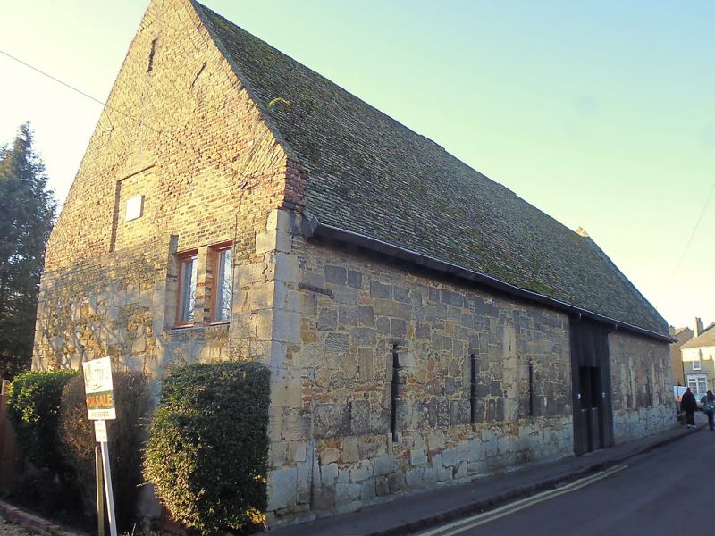
CROMWELL ROAD
1.
1082
THE Barn
TL 5380 1/238
II
2.
A 7""bay mediaeval barn, probably at one time connected with the nearby
hospitals of St John and St Mary Magdalene The walls are of squared
random stone with C17 or C18 brickwork above. The front facing Cromwell
Road has narrow slit granary windows (blocked). Roof tiled, with braced
tie-beam trusses.
Listing NGR: TL5368280301
External links are from the relevant listing authority and, where applicable, Wikidata. Wikidata IDs may be related buildings as well as this specific building. If you want to add or update a link, you will need to do so by editing the Wikidata entry.


Other nearby listed buildings
