Approximate Location Map
Large Map »
Latitude: 52.4001 / 52°24'0"N
Longitude: 0.2532 / 0°15'11"E
OS Eastings: 553388
OS Northings: 280394
OS Grid: TL533803
Mapcode National: GBR M6G.JTX
Mapcode Global: VHHJ6.BXPZ
Plus Code: 9F42C723+27
Entry Name: 16, Hills Lane
Listing Date: 19 June 1972
Grade: II
Source: Historic England
Source ID: 1167712
English Heritage Legacy ID: 48746
ID on this website: 101167712
Location: Ely, East Cambridgeshire, CB6
County: Cambridgeshire
District: East Cambridgeshire
Civil Parish: Ely
Built-Up Area: Ely
Traditional County: Cambridgeshire
Lieutenancy Area (Ceremonial County): Cambridgeshire
Church of England Parish: Ely
Church of England Diocese: Ely
Tagged with: Building
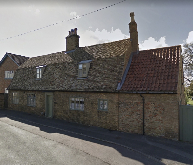
1. HILLS LANE
1082
No 16
TL 5380 3/53
II
2.
Built on a T shaped plan. Originally 2 C18 brick cottages, now I tenement.
1 storey and attics. 4 window range, C20 casementss with loaded lights
A 2-panel door has a simple doorcase with plain pilasters and cornice.
Roof tiled, mansard, old Cambridgeshire tiles. An extension at the north
end has pantiles.
Listing NGR: TL5338880394
External links are from the relevant listing authority and, where applicable, Wikidata. Wikidata IDs may be related buildings as well as this specific building. If you want to add or update a link, you will need to do so by editing the Wikidata entry.


Other nearby listed buildings
