Approximate Location Map
Large Map »
Latitude: 51.4104 / 51°24'37"N
Longitude: -1.576 / 1°34'33"W
OS Eastings: 429583
OS Northings: 168019
OS Grid: SU295680
Mapcode National: GBR 5YS.JCP
Mapcode Global: VHC1R.MTP4
Plus Code: 9C3WCC6F+5H
Entry Name: Tomkins Monument 3 Metres South of South Chancel Wall, in Churchyard of All Saints Church
Listing Date: 30 July 1986
Grade: II
Source: Historic England
Source ID: 1183527
English Heritage Legacy ID: 310735
ID on this website: 101183527
Location: All Saints' Church, Froxfield, Wiltshire, SN8
County: Wiltshire
Civil Parish: Froxfield
Traditional County: Wiltshire
Lieutenancy Area (Ceremonial County): Wiltshire
Tagged with: Monument
FROXFIELD CHURCH ROAD
SU 26 NE
(west side)
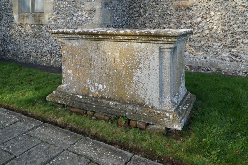
2/15 Tomkins monument 3m south of south
chancel wall, in churchyard of All
Saints Church
II
Chest tomb. C18. Limestone. Moulded table and base and recessed
corner pilasters. Inscription to GEORGE TOMKINS, partly obscured.
Listing NGR: SU2958368019
External links are from the relevant listing authority and, where applicable, Wikidata. Wikidata IDs may be related buildings as well as this specific building. If you want to add or update a link, you will need to do so by editing the Wikidata entry.


Other nearby listed buildings
