Approximate Location Map
Large Map »
Latitude: 51.4553 / 51°27'18"N
Longitude: -0.1122 / 0°6'43"W
OS Eastings: 531263
OS Northings: 174610
OS Grid: TQ312746
Mapcode National: GBR GR.0DC
Mapcode Global: VHGR6.0PK8
Plus Code: 9C3XFV4Q+44
Entry Name: Forecourt Walls to Number 46 and 48
Listing Date: 27 March 1981
Grade: II
Source: Historic England
Source ID: 1183653
English Heritage Legacy ID: 204051
ID on this website: 101183653
Location: Brixton, Lambeth, London, SW2
County: London
District: Lambeth
Electoral Ward/Division: Tulse Hill
Parish: Non Civil Parish
Built-Up Area: Lambeth
Traditional County: Surrey
Lieutenancy Area (Ceremonial County): Greater London
Church of England Parish: Tulse Hill Holy Trinity and St Matthias
Church of England Diocese: Southwark
Tagged with: Wall
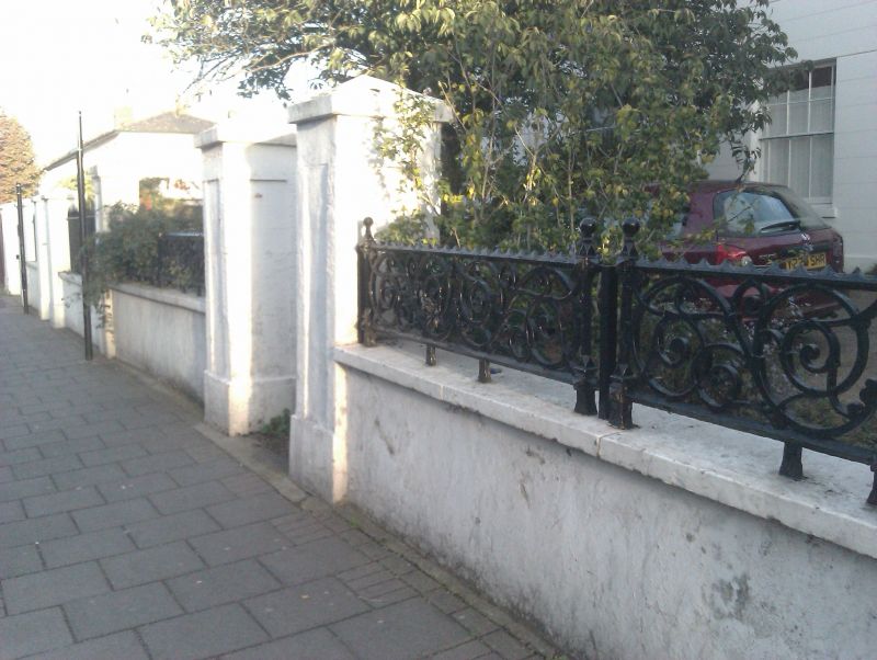
BRIXTON WATER LANE SW2
1. (south side)
5023
Forecourt Wall to
Nos 46 and 48
TQ 3174 23/103
II
2.
Low stuccoed wall with stone coping. Eight tall square piers with pyramidal
caps, paired opposite doors with singles at ends and between.
Listing NGR: TQ3126374610
External links are from the relevant listing authority and, where applicable, Wikidata. Wikidata IDs may be related buildings as well as this specific building. If you want to add or update a link, you will need to do so by editing the Wikidata entry.


Other nearby listed buildings
