Approximate Location Map
Large Map »
Latitude: 51.265 / 51°15'54"N
Longitude: 0.2035 / 0°12'12"E
OS Eastings: 553827
OS Northings: 154067
OS Grid: TQ538540
Mapcode National: GBR MN4.Q7Y
Mapcode Global: VHHPS.GGYL
Plus Code: 9F327683+29
Entry Name: Garden Walls Adjoining Knole
Listing Date: 13 April 1951
Grade: I
Source: Historic England
Source ID: 1204403
English Heritage Legacy ID: 172228
ID on this website: 101204403
Location: Knole Park, Sevenoaks, Kent, TN15
County: Kent
District: Sevenoaks
Civil Parish: Sevenoaks
Traditional County: Kent
Lieutenancy Area (Ceremonial County): Kent
Church of England Parish: Sevenoaks St Nicholas
Church of England Diocese: Rochester
Tagged with: Wall
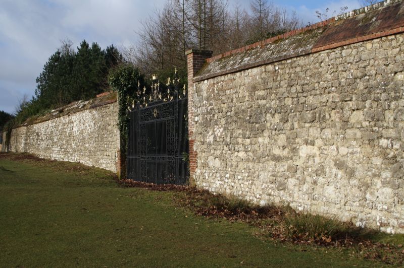
KNOLE PARK
1.
1614
----------
Garden Walls
adjoining Knole
TO 55 SW/4/82 13.4.51
1.
2.
Stone Garden wall.
Listing NGR: TQ5382754067
External links are from the relevant listing authority and, where applicable, Wikidata. Wikidata IDs may be related buildings as well as this specific building. If you want to add or update a link, you will need to do so by editing the Wikidata entry.


Other nearby listed buildings
