Approximate Location Map
Large Map »
Latitude: 53.386 / 53°23'9"N
Longitude: -1.923 / 1°55'22"W
OS Eastings: 405216
OS Northings: 387689
OS Grid: SK052876
Mapcode National: GBR HY08.GX
Mapcode Global: WHBB6.F5H1
Plus Code: 9C5W93PG+CQ
Entry Name: Stables to South West of Booth Farmhouse
Listing Date: 12 April 1984
Grade: II
Source: Historic England
Source ID: 1207204
English Heritage Legacy ID: 82115
ID on this website: 101207204
Location: High Peak, Derbyshire, SK22
County: Derbyshire
District: High Peak
Civil Parish: Hayfield
Traditional County: Derbyshire
Lieutenancy Area (Ceremonial County): Derbyshire
Church of England Parish: Hayfield St Matthew
Church of England Diocese: Derby
Tagged with: Stable
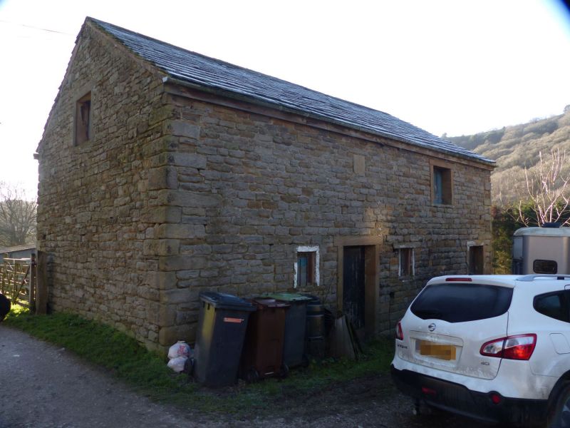
SK 08 NE PARISH OF HAYFIELD KINDER ROAD
2/I35 (East Side)
Stables to south-west of
Booth Farmhouse
GV II
Stables with loft. Dated I837. Coursed gritstone rubble. gritstone dressings
and quoins. North elevation - two doorways with flush surrounds, to east side
of each, two flush openings. Over east door datestone of I837. Included for
group value.
Listing NGR: SK0521687689
External links are from the relevant listing authority and, where applicable, Wikidata. Wikidata IDs may be related buildings as well as this specific building. If you want to add or update a link, you will need to do so by editing the Wikidata entry.


Other nearby listed buildings
