Approximate Location Map
Large Map »
Latitude: 50.7175 / 50°43'2"N
Longitude: -2.4411 / 2°26'27"W
OS Eastings: 368956
OS Northings: 90964
OS Grid: SY689909
Mapcode National: GBR PY.R6W3
Mapcode Global: FRA 57S5.SZ7
Plus Code: 9C2VPH85+XH
Entry Name: Roman House
Listing Date: 8 May 1950
Grade: I
Source: Historic England
Source ID: 1210098
English Heritage Legacy ID: 104222
ID on this website: 101210098
Location: Dorchester, Dorset, DT1
County: Dorset
Civil Parish: Dorchester
Built-Up Area: Dorchester
Traditional County: Dorset
Lieutenancy Area (Ceremonial County): Dorset
Church of England Parish: Dorchester and West Stafford
Church of England Diocese: Salisbury
Tagged with: House
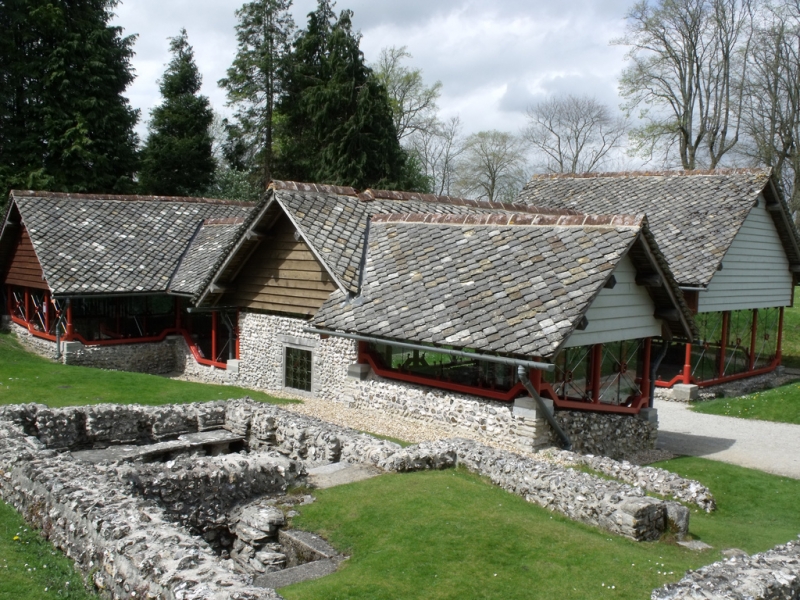
1. COLLITON PARK
5191
Roman House
SY 6890 7/6 8.5.50.
I
2.
Shortly after circa 307, enlarged after circa 341. Only Roman town house visible
in Britain. H-shaped west wing with hypocast and mosaic pavements. South
range added (also in C4) containing 1 heated room and 1 kitchen. Well north
of south range. Excavated 1938.
Listing NGR: SY6895690964
External links are from the relevant listing authority and, where applicable, Wikidata. Wikidata IDs may be related buildings as well as this specific building. If you want to add or update a link, you will need to do so by editing the Wikidata entry.


Other nearby listed buildings
