Approximate Location Map
Large Map »
Latitude: 51.2209 / 51°13'15"N
Longitude: 1.3417 / 1°20'30"E
OS Eastings: 633445
OS Northings: 152159
OS Grid: TR334521
Mapcode National: GBR X1V.J13
Mapcode Global: VHLGZ.6KNY
Plus Code: 9F3368CR+8M
Entry Name: Vine Cottage
Listing Date: 24 March 1987
Grade: II
Source: Historic England
Source ID: 1237007
English Heritage Legacy ID: 428155
ID on this website: 101237007
Location: Northbourne, Dover, Kent, CT14
County: Kent
District: Dover
Civil Parish: Northbourne
Traditional County: Kent
Lieutenancy Area (Ceremonial County): Kent
Tagged with: Cottage
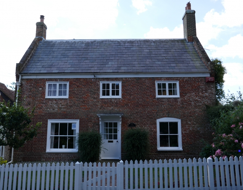
NORTHBOURNE THE STREET
TR 35 SW (south side)
4/41 Vine Cottage
GV II
House. Early C18. Red brick and slate roof. Two storeys on plinth
with wooden eaves to roof with kneelered parapet gables and stacks at
end left and end right. Three wooden casements on first floor and 2
sashes on ground floor, that to right with segmental head. Central half-
glazed door with flat hood on brackets. Later C19 wing attached to rear.
Included for group value.
Listing NGR: TR3344652155
External links are from the relevant listing authority and, where applicable, Wikidata. Wikidata IDs may be related buildings as well as this specific building. If you want to add or update a link, you will need to do so by editing the Wikidata entry.


Other nearby listed buildings
