Approximate Location Map
Large Map »
Latitude: 50.971 / 50°58'15"N
Longitude: 0.0218 / 0°1'18"E
OS Eastings: 542049
OS Northings: 121013
OS Grid: TQ420210
Mapcode National: GBR LQ8.0B4
Mapcode Global: FRA B6YJ.SDR
Plus Code: 9F22X2CC+CP
Entry Name: Burnt House
Listing Date: 27 September 1979
Grade: II
Source: Historic England
Source ID: 1237861
English Heritage Legacy ID: 415185
ID on this website: 101237861
Location: Newick, Lewes, East Sussex, BN8
County: East Sussex
District: Lewes
Civil Parish: Newick
Built-Up Area: Newick
Traditional County: Sussex
Lieutenancy Area (Ceremonial County): East Sussex
Church of England Parish: Newick St Mary
Church of England Diocese: Chichester
Tagged with: House
NEWICK CHURCH ROAD
1.
5206
(east side)
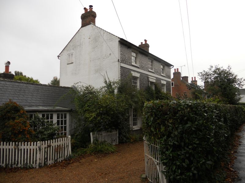
Burnt House
TQ 4221 19/80
II
2.
Early C19. Three storeys. Three windows. Faced with grey headers on ground
floor with painted brick quoins and with black mathematical tiles above. Wooden
stringcourse. Slate roof. Glazing bars intact. Porch of sentry-box type
containing a door of 6 moulded and fielded panels.
Listing NGR: TQ4204921013
External links are from the relevant listing authority and, where applicable, Wikidata. Wikidata IDs may be related buildings as well as this specific building. If you want to add or update a link, you will need to do so by editing the Wikidata entry.


Other nearby listed buildings
