Approximate Location Map
Large Map »
Latitude: 51.3865 / 51°23'11"N
Longitude: 0.3032 / 0°18'11"E
OS Eastings: 560357
OS Northings: 167792
OS Grid: TQ603677
Mapcode National: GBR Y4.H3G
Mapcode Global: VHHP8.6DMY
Plus Code: 9F3298P3+J7
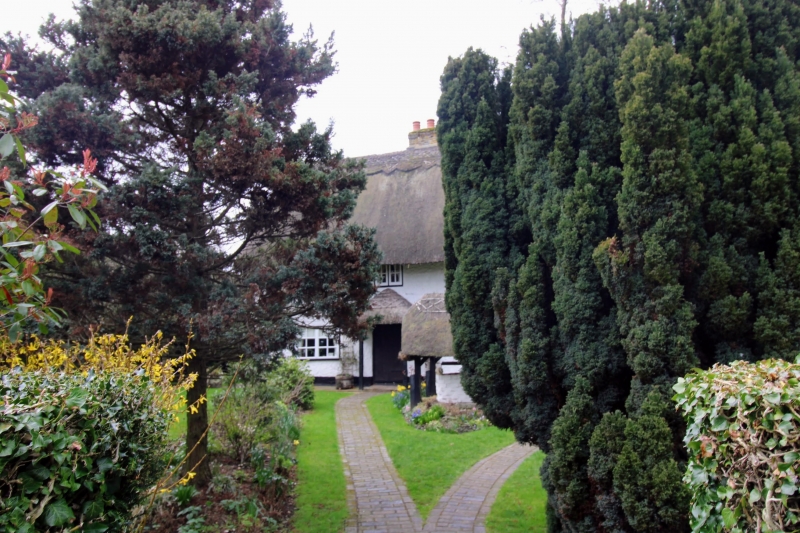
Entry Name: Hartley Cottage
Listing Date: 22 October 1982
Grade: II
Source: Historic England
Source ID: 1238241
English Heritage Legacy ID: 415703
ID on this website: 101238241
Location: Hartley, Sevenoaks, Kent, DA3
County: Kent
District: Sevenoaks
Civil Parish: Hartley
Built-Up Area: Hartley (Sevenoaks)
Traditional County: Kent
Lieutenancy Area (Ceremonial County): Kent
Church of England Parish: Hartley All Saints
Church of England Diocese: Rochester
Tagged with: Cottage Thatched cottage
HARTLEY CASTLE HILL
1.
5280
TQ 66 NW 4/155 Hartley Cottage
II
GV
2.
C18 or earlier. The property belonged to the Fairby Estate in the C18. Two storeys
faced with roughcast, the south wall weatherboarded. Three casement windows.
Thatched roof with pentice portion added on the north. Doorcase has hipped thatched
weather porch supported on rustic pillars.
Listing NGR: TQ6035767792
External links are from the relevant listing authority and, where applicable, Wikidata. Wikidata IDs may be related buildings as well as this specific building. If you want to add or update a link, you will need to do so by editing the Wikidata entry.


Other nearby listed buildings
