Approximate Location Map
Large Map »
Latitude: 51.3596 / 51°21'34"N
Longitude: 1.4433 / 1°26'35"E
OS Eastings: 639814
OS Northings: 167909
OS Grid: TR398679
Mapcode National: GBR X07.RQL
Mapcode Global: VHMCW.Y3W2
Plus Code: 9F339C5V+R8
Entry Name: 48 and 50, Albion Street
Listing Date: 20 September 1974
Grade: II
Source: Historic England
Source ID: 1238371
English Heritage Legacy ID: 415862
ID on this website: 101238371
Location: Broadstairs, Thanet, Kent, CT10
County: Kent
District: Thanet
Civil Parish: Broadstairs and St. Peters
Built-Up Area: Broadstairs
Traditional County: Kent
Lieutenancy Area (Ceremonial County): Kent
Tagged with: Building
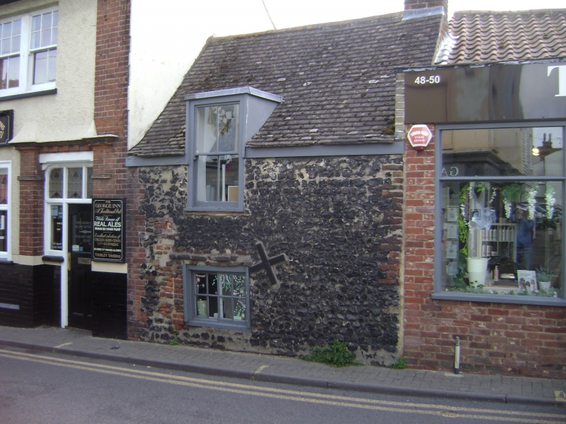
ALBION STREET
1.
5283 (South East Side)
BROADSTAIRS
Nos 48 & 50
TR 3967 NE 1/57
II GV
2.
C18, 1 storey flint-faced. The left side has a renewed tiled roof with semi-
dormer. Right side pantiled roof with 1 chimney. Iron cross braces. Red brick
quoins. The right hand side has a C19 shop front. The left hand side has a ground
floor sliding sash. Batten panelling inside.
Nos 40 to 50 (even) form a group.
Listing NGR: TR3981467909
External links are from the relevant listing authority and, where applicable, Wikidata. Wikidata IDs may be related buildings as well as this specific building. If you want to add or update a link, you will need to do so by editing the Wikidata entry.


Other nearby listed buildings
