Approximate Location Map
Large Map »
Latitude: 51.2875 / 51°17'14"N
Longitude: 0.1954 / 0°11'43"E
OS Eastings: 553187
OS Northings: 156550
OS Grid: TQ531565
Mapcode National: GBR T4.RY8
Mapcode Global: VHHPL.BWNW
Plus Code: 9F3275PW+X5
Entry Name: 128-134, St Johns Hill
Listing Date: 14 January 1974
Grade: II
Source: Historic England
Source ID: 1240949
English Heritage Legacy ID: 439546
ID on this website: 101240949
Location: St John's, Sevenoaks, Kent, TN13
County: Kent
District: Sevenoaks
Civil Parish: Sevenoaks
Built-Up Area: Sevenoaks
Traditional County: Kent
Lieutenancy Area (Ceremonial County): Kent
Church of England Parish: Sevenoaks St John the Baptist
Church of England Diocese: Rochester
Tagged with: Building
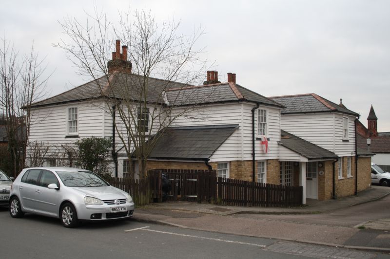
ST JOHNS HILL
1.
1614
(East Side)
Nos 128 to 134 (even)
TQ 55 NW/3/166
II
2.
Early C19 cottages. 2 storeys, stucco and weatherboarded on 1st floor.
Mostly sash window, with glazing bars intact, but a few casements also.
Some windows have shutters. Porch to No 132.
Listing NGR: TQ5318756550
External links are from the relevant listing authority and, where applicable, Wikidata. Wikidata IDs may be related buildings as well as this specific building. If you want to add or update a link, you will need to do so by editing the Wikidata entry.


Other nearby listed buildings
