Approximate Location Map
Large Map »
Latitude: 51.0697 / 51°4'11"N
Longitude: -1.7933 / 1°47'35"W
OS Eastings: 414579
OS Northings: 130065
OS Grid: SU145300
Mapcode National: GBR 517.X0H
Mapcode Global: FRA 7649.75Q
Plus Code: 9C3W3694+VM
Entry Name: 17, Winchester Street
Listing Date: 12 October 1972
Grade: II
Source: Historic England
Source ID: 1243376
English Heritage Legacy ID: 447156
ID on this website: 101243376
Location: Salisbury, Wiltshire, SP1
County: Wiltshire
Civil Parish: Salisbury
Built-Up Area: Salisbury
Traditional County: Wiltshire
Lieutenancy Area (Ceremonial County): Wiltshire
Church of England Parish: Salisbury St Thomas and St Edmund
Church of England Diocese: Salisbury
Tagged with: Building
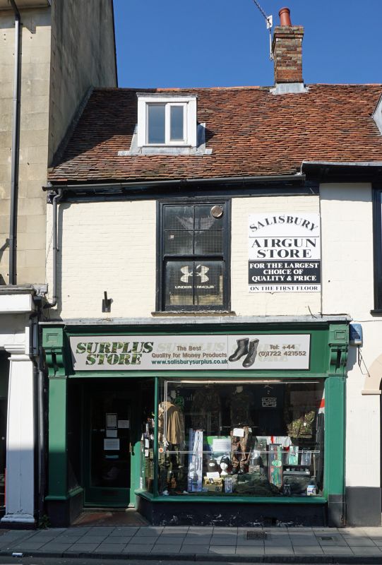
WINCHESTER STREET
1.
1594 (North Side)
No 17
SU 1430 SE 2/604
II GV
2.
Circa 1800 refronting of earlier structure possibly 2 storeys painted brick,
eaves band. Gable end old tile roof continued over Nos 19 and 21 qv. 1 tall
flush architrave framed sash window on lst floor. Modernised Victorian shop
front ground floor.
Nos 17 to 21 (odd) form a group.
Listing NGR: SU1457930065
External links are from the relevant listing authority and, where applicable, Wikidata. Wikidata IDs may be related buildings as well as this specific building. If you want to add or update a link, you will need to do so by editing the Wikidata entry.


Other nearby listed buildings
