Approximate Location Map
Large Map »
Latitude: 52.3939 / 52°23'38"N
Longitude: 0.2654 / 0°15'55"E
OS Eastings: 554244
OS Northings: 279737
OS Grid: TL542797
Mapcode National: GBR M6H.V8D
Mapcode Global: VHHJD.K354
Plus Code: 9F4297V8+H5
Entry Name: Castlehythe
Listing Date: 19 June 1972
Grade: II
Source: Historic England
Source ID: 1252301
English Heritage Legacy ID: 435278
ID on this website: 101252301
Location: Ely, East Cambridgeshire, CB7
County: Cambridgeshire
District: East Cambridgeshire
Civil Parish: Ely
Built-Up Area: Ely
Traditional County: Cambridgeshire
Lieutenancy Area (Ceremonial County): Cambridgeshire
Church of England Parish: Ely
Church of England Diocese: Ely
STATION ROAD
1.
1082
TL 5479 2/110 No 5 Castlehythe
II GV
2.
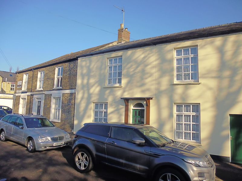
A mid C19 brick house, now cement rendered. 2 storeys. 2 window range,
double-hung sashes with glazing bars, in plain reveals. A central C20
door has a flat hood on brackets. Roof slate. Included for group value.
Nos 3 to 17 (odd) & No 2l form a pleasant group of Mid C19 gault brick houses
set back from the road.
Listing NGR: TL5424479737
External links are from the relevant listing authority and, where applicable, Wikidata. Wikidata IDs may be related buildings as well as this specific building. If you want to add or update a link, you will need to do so by editing the Wikidata entry.


Other nearby listed buildings
