Approximate Location Map
Large Map »
Latitude: 52.8235 / 52°49'24"N
Longitude: -2.182 / 2°10'55"W
OS Eastings: 387835
OS Northings: 325127
OS Grid: SJ878251
Mapcode National: GBR 16G.TDR
Mapcode Global: WHBDS.G967
Plus Code: 9C4VRRF9+C6
Entry Name: Village Farmhouse
Listing Date: 10 January 1972
Grade: II
Source: Historic England
Source ID: 1258045
English Heritage Legacy ID: 444166
ID on this website: 101258045
Location: Seighford, Stafford, Staffordshire, ST18
County: Staffordshire
District: Stafford
Civil Parish: Seighford
Traditional County: Staffordshire
Lieutenancy Area (Ceremonial County): Staffordshire
Church of England Parish: Seighford St Chad
Church of England Diocese: Lichfield
Tagged with: Farmhouse
SEIGHFORD
1.
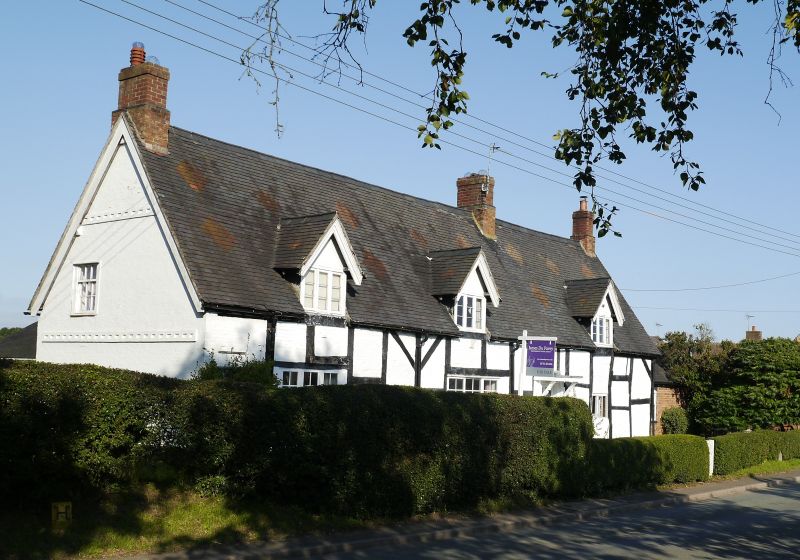
2385 Village Farmhouse
SJ 82 NE 12/19
II
2.
Probably Cl7 in origin. Timber framed and colourwashed brick with tiled
roof and brick stacks; 3 casement windows (2 modern) and 3 gabled dormers.
Listing NGR: SJ8783525127
External links are from the relevant listing authority and, where applicable, Wikidata. Wikidata IDs may be related buildings as well as this specific building. If you want to add or update a link, you will need to do so by editing the Wikidata entry.


Other nearby listed buildings
