Approximate Location Map
Large Map »
Latitude: 51.4094 / 51°24'33"N
Longitude: 0.1761 / 0°10'34"E
OS Eastings: 551442
OS Northings: 170064
OS Grid: TQ514700
Mapcode National: GBR SW.T8T
Mapcode Global: VHHP0.0TGY
Plus Code: 9F32C55G+QC
Entry Name: The Old Farmhouse
Listing Date: 22 October 1982
Grade: II
Source: Historic England
Source ID: 1267520
English Heritage Legacy ID: 416872
ID on this website: 101267520
Location: Hextable, Sevenoaks, Kent, BR8
County: Kent
District: Sevenoaks
Civil Parish: Hextable
Built-Up Area: Hextable
Traditional County: Kent
Lieutenancy Area (Ceremonial County): Kent
Church of England Parish: Swanley St Paul
Church of England Diocese: Rochester
Tagged with: Farmhouse
SWANLEY COLLEGE ROAD
1.
5280
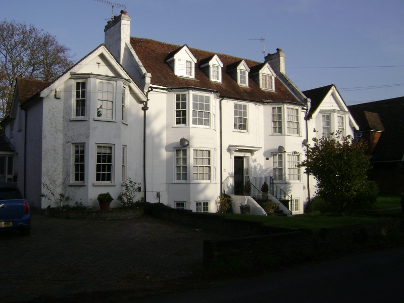
The Old Farmhouse
(Nos 1, 2 and 3)
TQ 57 SW 1/216
II
2.
Mid to late C18. Two storeys and attics stuccoed with modern tiled roof. Two
dormers. Gable ends with kneelers. Eaves cornice. Three bays, including 2 canted
bays of 3 windows each to both floors. Glazing bars intact. Doorcase with flat
wooden hood on brackets. C19 gabled addition to the south-west.
Listing NGR: TQ5145270060
External links are from the relevant listing authority and, where applicable, Wikidata. Wikidata IDs may be related buildings as well as this specific building. If you want to add or update a link, you will need to do so by editing the Wikidata entry.


Other nearby listed buildings
