Approximate Location Map
Large Map »
Latitude: 51.0685 / 51°4'6"N
Longitude: -1.7962 / 1°47'46"W
OS Eastings: 414374
OS Northings: 129932
OS Grid: SU143299
Mapcode National: GBR 517.W4S
Mapcode Global: FRA 7649.61V
Plus Code: 9C3W3693+CG
Entry Name: 41, Silver Street
Listing Date: 28 February 1952
Grade: II
Source: Historic England
Source ID: 1273010
English Heritage Legacy ID: 446776
ID on this website: 101273010
Location: Salisbury, Wiltshire, SP1
County: Wiltshire
Civil Parish: Salisbury
Built-Up Area: Salisbury
Traditional County: Wiltshire
Lieutenancy Area (Ceremonial County): Wiltshire
Church of England Parish: Salisbury St Thomas and St Edmund
Church of England Diocese: Salisbury
Tagged with: Building
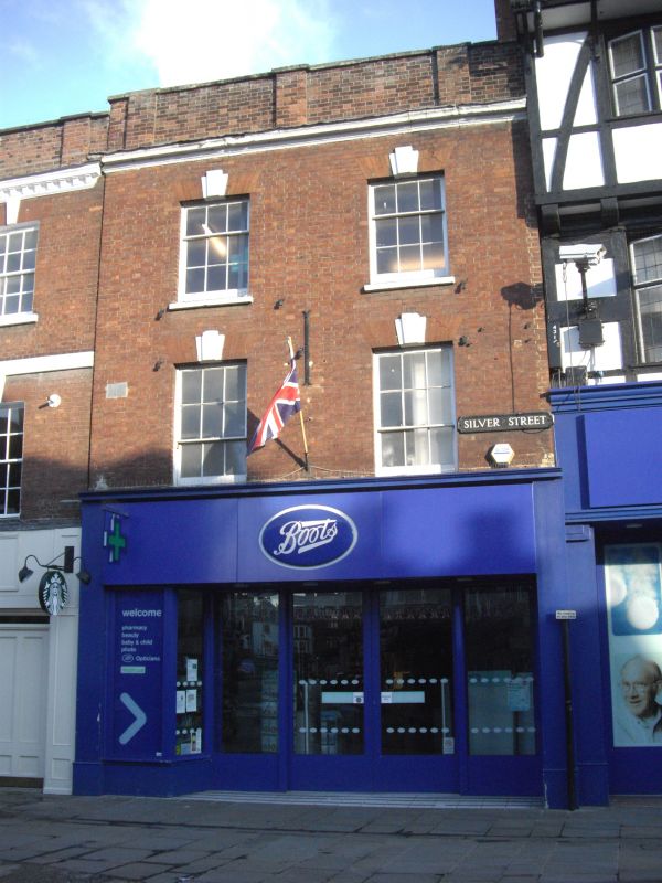
SILVER STREET
1.
1594 (South Side)
No 41
SU 1429 NW 3/325 28.2.52.
II GV
2.
Late Cl8. 3 storeys red brick with moulded cornice. Brick parapet with small
piers between bays and at corners, stone coping. 2 windows to upper floors,
with painted triple keystones, recessed sashes, glazing bars intact. Modern
shop front, ground floor.
Nos 37 to 41 (odd) form a group.
Listing NGR: SU1437429932
External links are from the relevant listing authority and, where applicable, Wikidata. Wikidata IDs may be related buildings as well as this specific building. If you want to add or update a link, you will need to do so by editing the Wikidata entry.


Other nearby listed buildings
