Approximate Location Map
Large Map »
Latitude: 52.5078 / 52°30'27"N
Longitude: -0.3284 / 0°19'42"W
OS Eastings: 513551
OS Northings: 291299
OS Grid: TL135912
Mapcode National: GBR GZ1.MT4
Mapcode Global: VHGL1.878C
Plus Code: 9C4XGM5C+4M
Entry Name: Earl's Farmhouse and Attached Barn to North East
Listing Date: 16 November 1988
Grade: II
Source: Historic England
Source ID: 1274857
English Heritage Legacy ID: 414068
ID on this website: 101274857
Location: Morborne, Huntingdonshire, Cambridgeshire, PE7
County: Cambridgeshire
District: Huntingdonshire
Civil Parish: Morborne
Traditional County: Huntingdonshire
Lieutenancy Area (Ceremonial County): Cambridgeshire
Church of England Parish: Morborne All Saints
Church of England Diocese: Ely
Tagged with: Farmhouse
MORBORNE MORBORNE
TL 1291
19/100 Earl's Farmhouse and
attached barn to
north-east
II
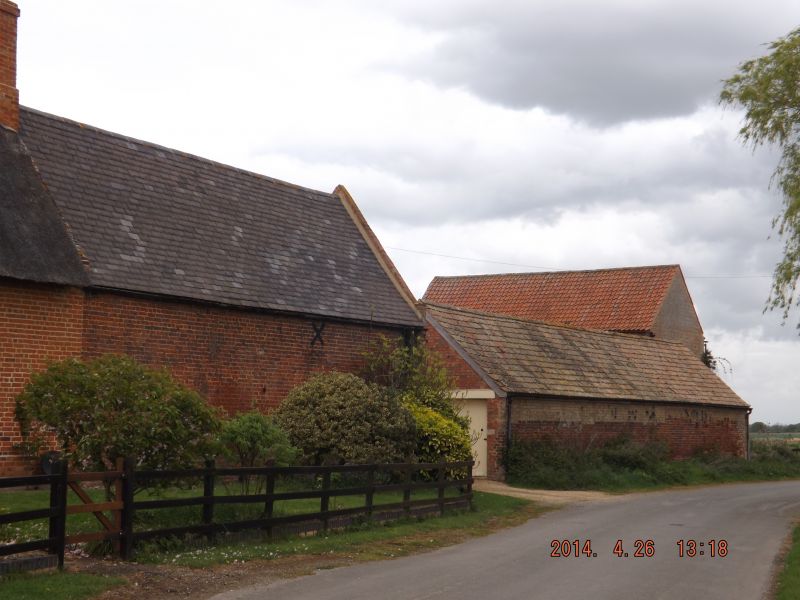
Farmhouse and attached barn. Late C16 or early C17 with early C19 additions
and alterations. Local red brick. Thatched and Collyweston slated roofs and
Welsh slated barn roof with parapet gables. One storey and attic; L-plan
with main north-east, south-west range including three units of an earlier
building; rear service wing to north-west and barn to north-east. Ridge
stack and end stack to right hand. C19 panelled door and rectangular
fanlight, sunk panelled pilastered doorcase and cornice hood supported by
shaped brackets. One sixteen-paned hung sash window to right hand and two
three-light casement windows; two three-light casement windows to left hand;
four eyebrow casement dormer windows. Earl's farmhouse is one of three
surviving buildings of the original village outlined clearly on aerial
photographs.
Aerial Photography Dept Cambs University
Listing NGR: TL1355191299
External links are from the relevant listing authority and, where applicable, Wikidata. Wikidata IDs may be related buildings as well as this specific building. If you want to add or update a link, you will need to do so by editing the Wikidata entry.


Other nearby listed buildings
