Approximate Location Map
Large Map »
Latitude: 52.917 / 52°55'1"N
Longitude: -1.491 / 1°29'27"W
OS Eastings: 434321
OS Northings: 335626
OS Grid: SK343356
Mapcode National: GBR PGH.8P
Mapcode Global: WHDGT.2Y85
Plus Code: 9C4WWG85+QH
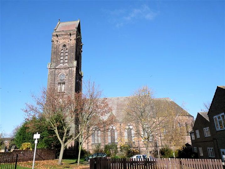
Entry Name: Church of St Luke
Listing Date: 24 February 1977
Grade: II*
Source: Historic England
Source ID: 1279315
English Heritage Legacy ID: 403482
ID on this website: 101279315
Location: St Luke's Church, Derby, Derbyshire, DE22
County: City of Derby
Electoral Ward/Division: Abbey
Parish: Non Civil Parish
Built-Up Area: Derby
Traditional County: Derbyshire
Lieutenancy Area (Ceremonial County): Derbyshire
Church of England Parish: Derby St Luke
Church of England Diocese: Derby
Tagged with: Church building
This list entry was subject to a Minor Amendment on 23 May 2023 to correct a typo in the description and to reformat the text to current standards
SK 3435
6/222
PARLIAMENT STREET
Church of St Luke
II*
Late C19. Early English Gothic style. Stone. Nave, chancel with polygonal apse and aisles. South-west tower. Undergoing restoration 1974/5.
Listing NGR: SK3432135626
External links are from the relevant listing authority and, where applicable, Wikidata. Wikidata IDs may be related buildings as well as this specific building. If you want to add or update a link, you will need to do so by editing the Wikidata entry.


Other nearby listed buildings
