Approximate Location Map
Large Map »
Latitude: 50.9146 / 50°54'52"N
Longitude: -0.1674 / 0°10'2"W
OS Eastings: 528922
OS Northings: 114391
OS Grid: TQ289143
Mapcode National: GBR JMY.LHC
Mapcode Global: FRA B6JP.JKN
Plus Code: 9C2XWR7M+R2
Entry Name: Dapps
Listing Date: 11 May 1983
Grade: II
Source: Historic England
Source ID: 1285407
English Heritage Legacy ID: 302660
ID on this website: 101285407
Location: Mid Sussex, BN6
County: West Sussex
District: Mid Sussex
Civil Parish: Hurstpierpoint and Sayers Common
Built-Up Area: Hurstpierpoint
Traditional County: Sussex
Lieutenancy Area (Ceremonial County): West Sussex
Church of England Parish: Hurstpierpoint
Church of England Diocese: Chichester
Tagged with: Building
HURSTPIERPOINT NEW WAY LANE
1.
5405
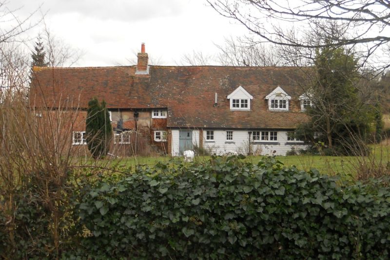
Dapps
TQ 21 SE 22/128
II
2.
C17 or earlier building with plaster infilling, now partly refaced with red brick.
Tiled roof. Casement windows. Oriel window on first floor of north gable end.
Two storeys. Three window. Modern addition at south end.
Listing NGR: TQ2892214391
External links are from the relevant listing authority and, where applicable, Wikidata. Wikidata IDs may be related buildings as well as this specific building. If you want to add or update a link, you will need to do so by editing the Wikidata entry.


Other nearby listed buildings
