Approximate Location Map
Large Map »
Latitude: 51.4574 / 51°27'26"N
Longitude: -0.3041 / 0°18'14"W
OS Eastings: 517925
OS Northings: 174524
OS Grid: TQ179745
Mapcode National: GBR 80.S22
Mapcode Global: VHGR2.PM3L
Plus Code: 9C3XFM4W+X9
Entry Name: 62-66, Hill Rise
Listing Date: 25 June 1983
Grade: II
Source: Historic England
Source ID: 1285980
English Heritage Legacy ID: 205468
ID on this website: 101285980
Location: Richmond upon Thames, London, TW10
County: London
District: Richmond upon Thames
Electoral Ward/Division: South Richmond
Parish: Non Civil Parish
Built-Up Area: Richmond upon Thames
Traditional County: Surrey
Lieutenancy Area (Ceremonial County): Greater London
Church of England Parish: Richmond
Church of England Diocese: Southwark
Tagged with: Building
1.
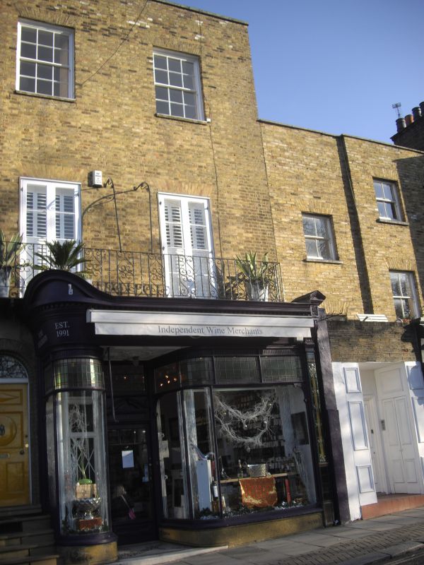
5028 HILL RISE
(east side)
Nos 62 to 66
TQ 1774 NE 20A/85
II
2.
Late C18-early C19. Three storeys, 2 windows wide. Stock brick. Very fine, late
C19, shop front.
(No 64 is the shop only).
Listing NGR: TQ1792874532
External links are from the relevant listing authority and, where applicable, Wikidata. Wikidata IDs may be related buildings as well as this specific building. If you want to add or update a link, you will need to do so by editing the Wikidata entry.


Other nearby listed buildings
