Approximate Location Map
Large Map »
Latitude: 51.5127 / 51°30'45"N
Longitude: -0.1086 / 0°6'30"W
OS Eastings: 531348
OS Northings: 180999
OS Grid: TQ313809
Mapcode National: GBR MC.SX
Mapcode Global: VHGR0.27GQ
Plus Code: 9C3XGV7R+3H
Entry Name: 6 King's Bench Walk
Listing Date: 4 January 1950
Grade: I
Source: Historic England
Source ID: 1286279
English Heritage Legacy ID: 199539
ID on this website: 101286279
Location: Holborn, City of London, London, EC4Y
County: London
District: City and County of the City of London
Electoral Ward/Division: Farringdon Without
Parish: Non Civil Parish
Built-Up Area: City of London
Traditional County: Middlesex
Lieutenancy Area (Ceremonial County): City of London
Tagged with: Building
TQ 3181 SW 7/112
TQ 3180 NW 13/112
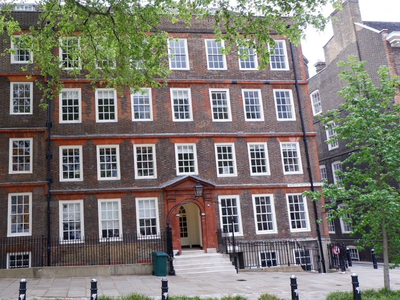
INNER TEMPLE EC4
King's Bench Walk (East Side)
No. 6
4.1.50.
GV
I
Late C17. Similar to No. 4 but without parapet to roof. Arched, bulk doorway with pilasters and pediment South flank wall and rear wall rebuilt in yellow stock brick. Railings to area with lamp arch.
Listing NGR: TQ3134880997
External links are from the relevant listing authority and, where applicable, Wikidata. Wikidata IDs may be related buildings as well as this specific building. If you want to add or update a link, you will need to do so by editing the Wikidata entry.


Other nearby listed buildings
