Approximate Location Map
Large Map »
Latitude: 51.2911 / 51°17'27"N
Longitude: 0.4069 / 0°24'24"E
OS Eastings: 567919
OS Northings: 157412
OS Grid: TQ679574
Mapcode National: GBR NPC.TZX
Mapcode Global: VHJM5.0TF4
Plus Code: 9F327CR4+CP
Entry Name: Lodge to Douce's Manor
Listing Date: 30 November 1993
Grade: II
Source: Historic England
Source ID: 1291671
English Heritage Legacy ID: 392436
ID on this website: 101291671
Location: West Malling, Tonbridge and Malling, Kent, ME19
County: Kent
District: Tonbridge and Malling
Civil Parish: West Malling
Built-Up Area: West Malling
Traditional County: Kent
Lieutenancy Area (Ceremonial County): Kent
Church of England Parish: West Malling St Mary
Church of England Diocese: Rochester
Tagged with: Gatehouse
WEST MALLING
TQ6757 ST LEONARD'S STREET
1156-0/2/124 No.16
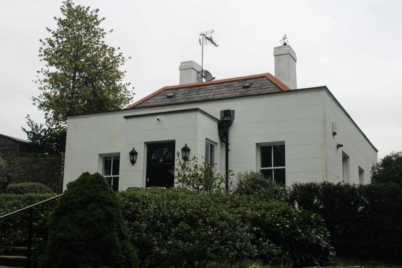
Lodge to Douce's Manor
GV II
Lodge. Mid C19. Stuccoed with slate roof. 1 storey 2 windows.
Sashes with horns and central doorcase with 4-panelled door
with hood and brackets above.
Listing NGR: TQ6791957412
External links are from the relevant listing authority and, where applicable, Wikidata. Wikidata IDs may be related buildings as well as this specific building. If you want to add or update a link, you will need to do so by editing the Wikidata entry.


Other nearby listed buildings
