Approximate Location Map
Large Map »
Latitude: 51.6301 / 51°37'48"N
Longitude: -0.7517 / 0°45'5"W
OS Eastings: 486500
OS Northings: 193105
OS Grid: SU865931
Mapcode National: GBR D54.NT2
Mapcode Global: VHDW4.X9H6
Plus Code: 9C3XJ6JX+28
Entry Name: 11, Church Street
Listing Date: 28 June 1973
Grade: II
Source: Historic England
Source ID: 1310868
English Heritage Legacy ID: 46001
ID on this website: 101310868
Location: High Wycombe, Buckinghamshire, HP11
County: Buckinghamshire
Electoral Ward/Division: Abbey
Parish: Non Civil Parish
Built-Up Area: High Wycombe
Traditional County: Buckinghamshire
Lieutenancy Area (Ceremonial County): Buckinghamshire
Church of England Parish: High Wycombe All Saints
Church of England Diocese: Oxford
Tagged with: Building
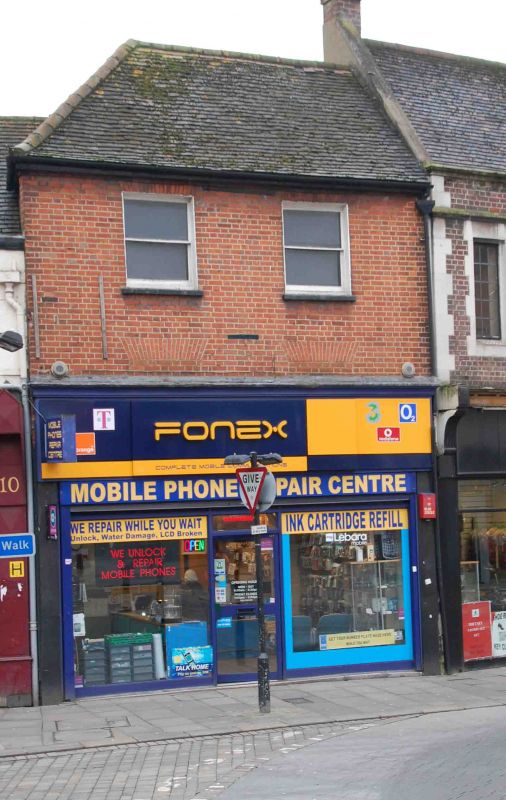
CHURCH STREET
1.
963
No 11
SU 8693 SE 2/230
II GV
2.
C18 front of red brick, hipped old tiled roof with corbelled brick cornice,
Once 3 storeys, 1st floor windows now blocked. Modern shop, tall fascia,
no cornice. 2 2nd floor sashes in reveals under flat arches.
Nos 8 to 11 (consec) form a group.
Listing NGR: SU8650193103
External links are from the relevant listing authority and, where applicable, Wikidata. Wikidata IDs may be related buildings as well as this specific building. If you want to add or update a link, you will need to do so by editing the Wikidata entry.


Other nearby listed buildings
