Approximate Location Map
Large Map »
Latitude: 52.0771 / 52°4'37"N
Longitude: 0.1765 / 0°10'35"E
OS Eastings: 549253
OS Northings: 244321
OS Grid: TL492443
Mapcode National: GBR MB7.PG2
Mapcode Global: VHHKX.01NZ
Plus Code: 9F4235GG+VJ
Entry Name: Cemetery Chapel
Listing Date: 17 December 1986
Grade: II
Source: Historic England
Source ID: 1317465
English Heritage Legacy ID: 53054
ID on this website: 101317465
Location: Ickleton, South Cambridgeshire, CB10
County: Cambridgeshire
District: South Cambridgeshire
Civil Parish: Ickleton
Built-Up Area: Ickleton
Traditional County: Cambridgeshire
Lieutenancy Area (Ceremonial County): Cambridgeshire
Church of England Parish: Ickleton
Church of England Diocese: Ely
Tagged with: Chapel
TL 44SE ICKLETON HINXTON ROAD
(West side)
6/242 Cemetery Chapel
II
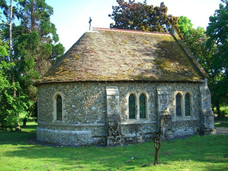
Cemetery Chapel. c.1883. Early English style. Flint with limestone
dressings slated roofs. One storey. Apsidal east end and double boarded
doors to west and mortuary to south. Lancet windows; jambs with mitre stops
and mouldings dying at impost height.
Listing NGR: TL4925344321
External links are from the relevant listing authority and, where applicable, Wikidata. Wikidata IDs may be related buildings as well as this specific building. If you want to add or update a link, you will need to do so by editing the Wikidata entry.


Other nearby listed buildings
