Approximate Location Map
Large Map »
Latitude: 51.5893 / 51°35'21"N
Longitude: -2.3985 / 2°23'54"W
OS Eastings: 372488
OS Northings: 187905
OS Grid: ST724879
Mapcode National: GBR JZ.C5CG
Mapcode Global: VH95M.C9VZ
Plus Code: 9C3VHJQ2+PH
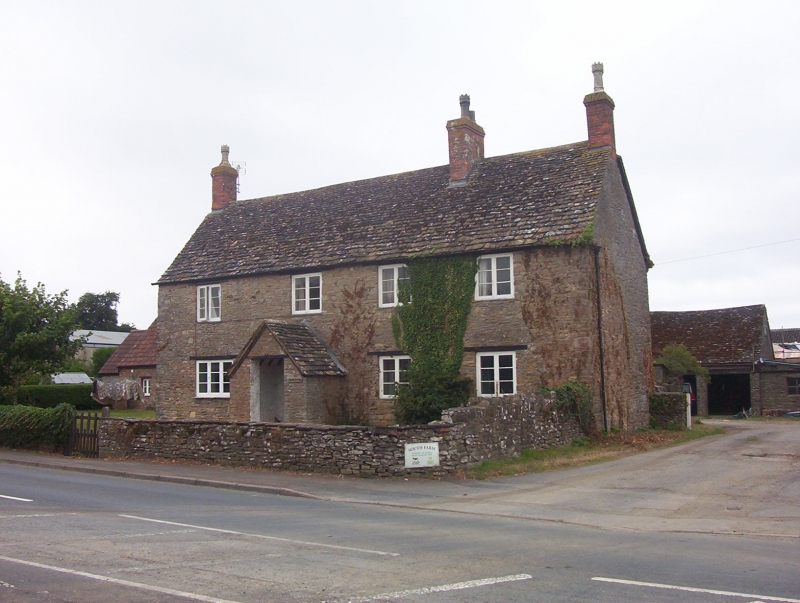
Entry Name: South Farmhouse
Listing Date: 5 June 1984
Grade: II
Source: Historic England
Source ID: 1321153
English Heritage Legacy ID: 34830
ID on this website: 101321153
Location: Wickwar, South Gloucestershire, GL12
County: South Gloucestershire
Civil Parish: Wickwar
Built-Up Area: Wickwar
Traditional County: Gloucestershire
Lieutenancy Area (Ceremonial County): Gloucestershire
Church of England Parish: Wickwar Holy Trinity
Church of England Diocese: Gloucester
Tagged with: Farmhouse
ST 78 NW WICKWAR SODBURY ROAD (west side)
4/206 South Farmhouse
- II
Farmhouse. Early - mid C18. Rubble; plain tiled roof; brick stacks. L-plan.
2 storeys and attics. Four 2- and 3-light casement windows under exposed
lintels. Off-centre door to left and gabled projecting porch.
Listing NGR: ST7248887905
External links are from the relevant listing authority and, where applicable, Wikidata. Wikidata IDs may be related buildings as well as this specific building. If you want to add or update a link, you will need to do so by editing the Wikidata entry.


Other nearby listed buildings
